
 Châtillon
Dijon
Semur-en-Auxois
Talence
Écully
Lannion
Perpignan
Meudon
Caen
La Gaude
Courbevoie
Clichy
Cholet
Herblay
Nimes
Plaisir
Taden
Tarbes
Saint-Just
Châtillon
Dijon
Semur-en-Auxois
Talence
Écully
Lannion
Perpignan
Meudon
Caen
La Gaude
Courbevoie
Clichy
Cholet
Herblay
Nimes
Plaisir
Taden
Tarbes
Saint-Just
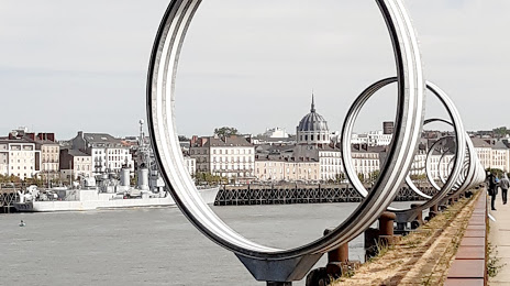
Nantes on the map, France
Where is located Nantes
Exact location — Nantes, Loire-Atlantique, Pays de la Loire, France, marked on the map with a red marker.
Coordinates
Nantes, France coordinates in decimal format: latitude — 47.218371, longitude — -1.553621. When converted to degrees, minutes, seconds Nantes has the following coordinates: 47°13′6.14 north latitude and -1°33′13.04 east longitude.
Population
Nantes, Loire-Atlantique, Pays de la Loire, France, according to our data the population is — 284,677 residents, which is about 0.4% of the total population of the country (France).
Comparison of the population on the graph:
Exact time
Time zone for this location Nantes — UTC +2 Europe/Paris. Exact time — friday, 5 may 2024 year, 08 h. 51 minute.
Sunrise and sunset
Nantes, sunrise and sunset data for a date — friday 3.05.2024.
| Sunrise | Sunset | Day (duration) |
|---|---|---|
| 06:49 -2 minutes | 21:16 +1 minute | 14 h. 30 minutes. +3 minutes |
You can control the scale of the map using the auxiliary tools to find out exactly where it is located Nantes. When you change the scale of the map, the width of the ruler also changes (in kilometers and miles).
Nearby cities
The largest cities that are located nearby:
- Angers — 79 km
- Rennes — 100 km
- Le Mans — 156 km
- Tours — 169 km
- Caen — 233 km
- Brest — 251 km
- Limoges — 265 km
- Orléans — 268 km
- Bordeaux — 274 km
- Le Havre — 278 km
- Rouen — 311 km
- Boulogne-Billancourt — 329 km
- Bournemouth
 (United Kingdom) — 388 km
 - Clermont-Ferrand — 392 km
- Portsmouth (United Kingdom) — 399 km
- Amiens — 403 km
- Southampton (United Kingdom) — 408 km
- Exeter (United Kingdom) — 411 km
- Eastbourne (United Kingdom) — 413 km
Distance to neighboring capitals:
- London (United Kingdom) — 488 km
- Andorra la Vella
 (Andorra) — 577 km
 - Brussels
 (Belgium) — 590 km
 - Bern
 (Switzerland) — 682 km
 - Amsterdam
 (Netherlands) — 736 km
 - Madrid
 (Spain) — 776 km
 - Vaduz
 (Liechtenstein) — 837 km
 - Lisbon
 (Portugal) — 1128 km
 - Prague
 (Czech Republic) — 1215 km
 - Berlin
 (Germany) — 1220 km
 - Rome
 (Italy) — 1258 km
 - Vienna
 (Austria) — 1343 km
 - Copenhagen
 (Denmark) — 1353 km
 - Warsaw
 (Poland) — 1707 km
 - Nicosia
 — 3181 km
Attractions


Distance to the capital
Distance to the capital (Paris) is about — 343 km.