
 Maureville
Samoëns
Gréning
Toulouse
Volx
Goudet
Méhoncourt
Saint-Hymer
Pontcarré
Maureville
Samoëns
Gréning
Toulouse
Volx
Goudet
Méhoncourt
Saint-Hymer
Pontcarré
Square Élisa-Mercœur on the map, Nantes, France
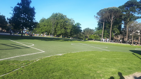
Photo
Where is located Square Élisa-Mercœur
Square Élisa-Mercœur — local attraction, which is located at Cr John Kennedy, 44000 Nantes, France and belongs to the category — city park. Average visitor rating for this place — 4.3 (according to 810 ratings, information from open sources and relevant for 2022).
Exact location — Square Élisa-Mercœur, marked on the map with a red marker.
You can get directions to Square Élisa-Mercœur on the map from your location.
What else is interesting in Nantes? You can see all the sights if you go to the city page.
Coordinates
Square Élisa-Mercœur, France coordinates in decimal format: latitude — 47.214967441385426, longitude — -1.5491332749281876. When converted to degrees, minutes, seconds Square Élisa-Mercœur has the following coordinates: 47°12′53.88 north latitude and -1°32′56.88 east longitude.
Nearby cities
The largest cities that are located nearby:
- Angers — 79 km
- Rennes — 100 km
- Le Mans — 156 km
- Tours — 169 km
- Caen — 233 km
- Brest — 251 km
- Limoges — 265 km
- Orléans — 268 km
- Bordeaux — 274 km
- Le Havre — 278 km
- Rouen — 311 km
- Boulogne-Billancourt — 329 km
- Bournemouth
 (United Kingdom) — 388 km
 - Clermont-Ferrand — 392 km
- Portsmouth (United Kingdom) — 399 km
- Amiens — 403 km
- Southampton (United Kingdom) — 408 km
- Exeter (United Kingdom) — 411 km
- Eastbourne (United Kingdom) — 413 km
Distance to the capital
Distance to the capital (Paris) is about — 343 km.