
 Maureville
Samoëns
Gréning
Toulouse
Volx
Goudet
Méhoncourt
Saint-Hymer
Pontcarré
Maureville
Samoëns
Gréning
Toulouse
Volx
Goudet
Méhoncourt
Saint-Hymer
Pontcarré
La Batterie de Dollemard on the map, Le Havre, France
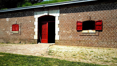
Photo
Where is located La Batterie de Dollemard
La Batterie de Dollemard — local attraction, which is located at 76310 Sainte-Adresse, France and belongs to the category — historical landmark. Average visitor rating for this place — 4.2 (according to 70 ratings, information from open sources and relevant for 2022).
Exact location — La Batterie de Dollemard, marked on the map with a red marker.
You can get directions to La Batterie de Dollemard on the map from your location.
What else is interesting in Le Havre? You can see all the sights if you go to the city page.
Coordinates
La Batterie de Dollemard, France coordinates in decimal format: latitude — 49.51692085231057, longitude — 0.0682655251526321. When converted to degrees, minutes, seconds La Batterie de Dollemard has the following coordinates: 49°31′0.92 north latitude and 0°4′5.76 east longitude.
Nearby cities
The largest cities that are located nearby:
- Caen — 49 km
- Rouen — 72 km
- Eastbourne
 (United Kingdom) — 141 km
 - Amiens — 162 km
- Le Mans — 165 km
- Portsmouth (United Kingdom) — 169 km
- Boulogne-Billancourt — 171 km
- Crawley (United Kingdom) — 180 km
- Southampton (United Kingdom) — 189 km
- Bournemouth (United Kingdom) — 194 km
- Rennes — 201 km
- Sutton (United Kingdom) — 207 km
- Gillingham (United Kingdom) — 211 km
- Orléans — 221 km
- London (United Kingdom) — 223 km
- Slough (United Kingdom) — 228 km
- Angers — 228 km
- Reading (United Kingdom) — 229 km
- Southend-on-Sea (United Kingdom) — 231 km
Distance to the capital
Distance to the capital (Paris) is about — 182 km.