
 Maureville
Samoëns
Gréning
Toulouse
Volx
Goudet
Méhoncourt
Saint-Hymer
Pontcarré
Maureville
Samoëns
Gréning
Toulouse
Volx
Goudet
Méhoncourt
Saint-Hymer
Pontcarré
Musée des Beaux-Arts on the map, Angers, France
Photo
Where is located Musée des Beaux-Arts
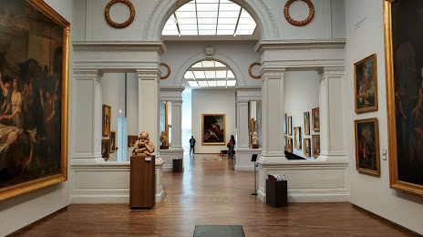
Musée des Beaux-Arts — local attraction, which is located at 14 Rue du Musée, 49100 Angers, France and belongs to the category — museum. Average visitor rating for this place — 4.5 (according to 483 ratings, information from open sources and relevant for 2022).
Exact location — Musée des Beaux-Arts, marked on the map with a red marker.
You can get directions to Musée des Beaux-Arts on the map from your location.
What else is interesting in Angers? You can see all the sights if you go to the city page.
Coordinates
Musée des Beaux-Arts, France coordinates in decimal format: latitude — 47.468816616185904, longitude — -0.5563227749194118. When converted to degrees, minutes, seconds Musée des Beaux-Arts has the following coordinates: 47°28′7.74 north latitude and -0°33′22.76 east longitude.
Nearby cities
The largest cities that are located nearby:
- Nantes — 80 km
- Le Mans — 81 km
- Tours — 94 km
- Rennes — 108 km
- Caen — 189 km
- Orléans — 189 km
- Le Havre — 228 km
- Limoges — 230 km
- Rouen — 248 km
- Boulogne-Billancourt — 253 km
- Bordeaux — 292 km
- Brest — 305 km
- Amiens — 336 km
- Clermont-Ferrand — 339 km
- Eastbourne
 (United Kingdom) — 369 km
 - Bournemouth (United Kingdom) — 370 km
- Portsmouth (United Kingdom) — 371 km
- Southampton (United Kingdom) — 384 km
- Reims — 386 km
Distance to the capital
Distance to the capital (Paris) is about — 265 km.