
 Maureville
Samoëns
Gréning
Toulouse
Volx
Goudet
Méhoncourt
Saint-Hymer
Pontcarré
Maureville
Samoëns
Gréning
Toulouse
Volx
Goudet
Méhoncourt
Saint-Hymer
Pontcarré
Gulf Park on the map, Vannes, France
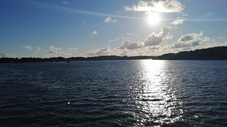
Photo
Where is located Gulf Park
Gulf Park — local attraction, which is located at 41 Av. Maréchal Juin Maréchal de France, 56000 Vannes, France and belongs to the category — wildlife refuge. Average visitor rating for this place — 4.5 (according to 507 ratings, information from open sources and relevant for 2022).
Exact location — Gulf Park, marked on the map with a red marker.
You can get directions to Gulf Park on the map from your location.
What else is interesting in Vannes? You can see all the sights if you go to the city page.
Coordinates
Gulf Park, France coordinates in decimal format: latitude — 47.632464344244525, longitude — -2.7689949748191722. When converted to degrees, minutes, seconds Gulf Park has the following coordinates: 47°37′56.87 north latitude and -2°46′8.38 east longitude.
Nearby cities
The largest cities that are located nearby:
- Rennes — 95 km
- Nantes — 103 km
- Brest — 150 km
- Angers — 165 km
- Le Mans — 222 km
- Caen — 241 km
- Tours — 260 km
- Le Havre — 289 km
- Rouen — 341 km
- Exeter
 (United Kingdom) — 343 km
 - Bournemouth (United Kingdom) — 344 km
- Orléans — 347 km
- Bordeaux — 356 km
- Portsmouth (United Kingdom) — 369 km
- Limoges — 370 km
- Southampton (United Kingdom) — 372 km
- Boulogne-Billancourt — 387 km
- Eastbourne (United Kingdom) — 405 km
- Bristol (Great Britain) — 420 km
Distance to the capital
Distance to the capital (Paris) is about — 403 km.