
 Maureville
Samoëns
Gréning
Toulouse
Volx
Goudet
Méhoncourt
Saint-Hymer
Pontcarré
Maureville
Samoëns
Gréning
Toulouse
Volx
Goudet
Méhoncourt
Saint-Hymer
Pontcarré
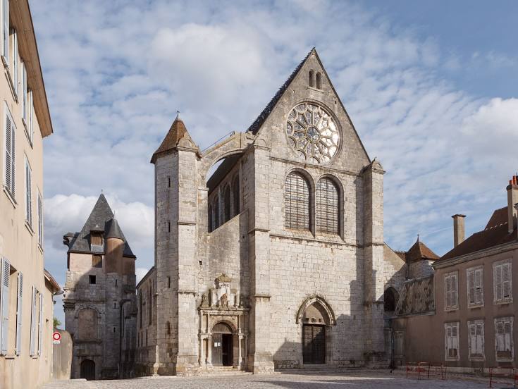
Église catholique Saint-Aignan on the map, Chartres, France
Photo
Where is located Église catholique Saint-Aignan
Église catholique Saint-Aignan — local attraction, which is located at 12 Pl. de l'Étape au Vin, 28000 Chartres, France and belongs to the category — catholic church. Average visitor rating for this place — 4.4 (according to 190 ratings, information from open sources and relevant for 2022).
Exact location — Église catholique Saint-Aignan, marked on the map with a red marker.
You can get directions to Église catholique Saint-Aignan on the map from your location.
What else is interesting in Chartres? You can see all the sights if you go to the city page.
Coordinates
Église catholique Saint-Aignan, France coordinates in decimal format: latitude — 48.444391994576065, longitude — 1.490048698026274. When converted to degrees, minutes, seconds Église catholique Saint-Aignan has the following coordinates: 48°26′39.81 north latitude and 1°29′24.18 east longitude.
Nearby cities
The largest cities that are located nearby:
- Orléans — 67 km
- Boulogne-Billancourt — 70 km
- Le Mans — 107 km
- Rouen — 114 km
- Tours — 131 km
- Le Havre — 153 km
- Caen — 157 km
- Amiens — 170 km
- Angers — 187 km
- Reims — 204 km
- Rennes — 237 km
- Lille — 265 km
- Nantes — 266 km
- Eastbourne
 (United Kingdom) — 270 km
 - Limoges — 289 km
- Dijon — 294 km
- Charleroi
 (Belgium) — 301 km
 - Crawley (United Kingdom) — 317 km
- Portsmouth (United Kingdom) — 318 km
Distance to the capital
Distance to the capital (Paris) is about — 78 km.