
 Maureville
Samoëns
Gréning
Toulouse
Volx
Goudet
Méhoncourt
Saint-Hymer
Pontcarré
Maureville
Samoëns
Gréning
Toulouse
Volx
Goudet
Méhoncourt
Saint-Hymer
Pontcarré
Carreau des Halles on the map, Bayonne, France
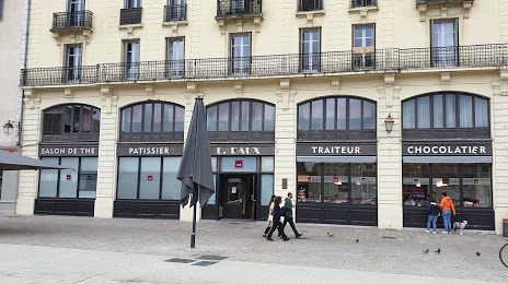
Photo
Where is located Carreau des Halles
Carreau des Halles — local attraction, which is located at 27 Quai Commandant Roquebert, 64100 Bayonne, France and belongs to the category — market. Average visitor rating for this place — 4.3 (according to 696 ratings, information from open sources and relevant for 2022).
Exact location — Carreau des Halles, marked on the map with a red marker.
You can get directions to Carreau des Halles on the map from your location.
What else is interesting in Bayonne? You can see all the sights if you go to the city page.
Coordinates
Carreau des Halles, France coordinates in decimal format: latitude — 43.49032326079103, longitude — -1.4750940021410064. When converted to degrees, minutes, seconds Carreau des Halles has the following coordinates: 43°29′25.16 north latitude and -1°28′30.34 east longitude.
Nearby cities
The largest cities that are located nearby:
- San Sebastián
 (Spain) — 45 km
 - Pamplona (Spain) — 76 km
- Bilbao (Spain) — 120 km
- Vitoria-Gasteiz (Spain) — 120 km
- Logroño (Spain) — 139 km
- Bordeaux — 164 km
- Santander (Spain) — 187 km
- Zaragoza (Spain) — 210 km
- Burgos (Spain) — 222 km
- Toulouse — 234 km
- Lleida (Spain) — 270 km
- Limoges — 334 km
- Gijón (Spain) — 336 km
- Valladolid (Spain) — 337 km
- Tarragona (Spain) — 347 km
- León (Spain) — 347 km
- Oviedo (Spain) — 352 km
- Terrassa (Spain) — 359 km
- Perpignan — 366 km
Distance to the capital
Distance to the capital (Paris) is about — 665 km.