
 Maureville
Samoëns
Gréning
Toulouse
Volx
Goudet
Méhoncourt
Saint-Hymer
Pontcarré
Maureville
Samoëns
Gréning
Toulouse
Volx
Goudet
Méhoncourt
Saint-Hymer
Pontcarré
Château Tour Saint Christophe on the map, Libourne, France
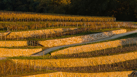
Photo
Where is located Château Tour Saint Christophe
Château Tour Saint Christophe — local attraction, which is located at 1 Casse Vert, 33330 Saint-Christophe-des-Bardes, France and belongs to the category — winery. Average visitor rating for this place — 4.9 (according to 56 ratings, information from open sources and relevant for 2022).
Exact location — Château Tour Saint Christophe, marked on the map with a red marker.
You can get directions to Château Tour Saint Christophe on the map from your location.
What else is interesting in Libourne? You can see all the sights if you go to the city page.
Coordinates
Château Tour Saint Christophe, France coordinates in decimal format: latitude — 44.89076007469575, longitude — -0.1295148020951446. When converted to degrees, minutes, seconds Château Tour Saint Christophe has the following coordinates: 44°53′26.74 north latitude and -0°7′46.25 east longitude.
Nearby cities
The largest cities that are located nearby:
- Bordeaux — 28 km
- Limoges — 154 km
- Toulouse — 198 km
- San Sebastián
 (Spain) — 225 km
 - Pamplona (Spain) — 259 km
- Nantes — 273 km
- Clermont-Ferrand — 274 km
- Tours — 283 km
- Bilbao (Spain) — 283 km
- Angers — 285 km
- Vitoria-Gasteiz (Spain) — 301 km
- Logroño (Spain) — 325 km
- Santander (Spain) — 328 km
- Le Mans — 344 km
- Perpignan — 354 km
- Montpellier — 360 km
- Saint-Étienne — 364 km
- Zaragoza (Spain) — 365 km
- Orléans — 367 km
Distance to the capital
Distance to the capital (Paris) is about — 480 km.