
 Maureville
Samoëns
Gréning
Toulouse
Volx
Goudet
Méhoncourt
Saint-Hymer
Pontcarré
Maureville
Samoëns
Gréning
Toulouse
Volx
Goudet
Méhoncourt
Saint-Hymer
Pontcarré
Étang du Vignoble on the map, Valenciennes, France
Photo
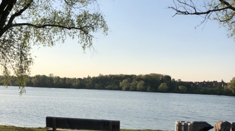
Where is located Étang du Vignoble
Étang du Vignoble — local attraction, which is located at Chem. du Halage, 59300 Valenciennes, France and belongs to the category — fishing pond. Average visitor rating for this place — 4.4 (according to 476 ratings, information from open sources and relevant for 2022).
Exact location — Étang du Vignoble, marked on the map with a red marker.
You can get directions to Étang du Vignoble on the map from your location.
What else is interesting in Valenciennes? You can see all the sights if you go to the city page.
Coordinates
Étang du Vignoble, France coordinates in decimal format: latitude — 50.3465228468228, longitude — 3.5022541980941444. When converted to degrees, minutes, seconds Étang du Vignoble has the following coordinates: 50°20′47.48 north latitude and 3°30′8.12 east longitude.
Nearby cities
The largest cities that are located nearby:
- Lille — 44 km
- Charleroi
 (Belgium) — 66 km
 - Brussels (Belgium) — 80 km
- Namur (Belgium) — 96 km
- Amiens — 101 km
- Antwerp (Belgium) — 113 km
- Reims — 127 km
- Liège (Belgium) — 148 km
- Breda
 (Netherlands) — 161 km
 - Maastricht (Netherlands) — 161 km
- Tilburg (Netherlands) — 171 km
- Dordrecht (Netherlands) — 180 km
- Eindhoven (Netherlands) — 180 km
- Rotterdam (Netherlands) — 185 km
- Aachen
 (Germany) — 185 km
 - Boulogne-Billancourt — 192 km
- 's-Hertogenbosch (Netherlands) — 192 km
- The Hague (Netherlands) — 197 km
- Zoetermeer (Netherlands) — 200 km
Distance to the capital
Distance to the capital (Paris) is about — 185 km.