
 Maureville
Samoëns
Gréning
Toulouse
Volx
Goudet
Méhoncourt
Saint-Hymer
Pontcarré
Maureville
Samoëns
Gréning
Toulouse
Volx
Goudet
Méhoncourt
Saint-Hymer
Pontcarré
Forêt de Raismes-Saint-Amand-Wallers on the map, Valenciennes, France
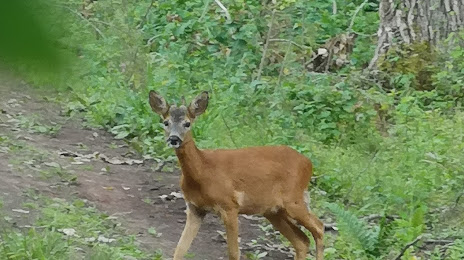
Photo
Where is located Forêt de Raismes-Saint-Amand-Wallers
Forêt de Raismes-Saint-Amand-Wallers — local attraction, which is located at no data and belongs to the category — -. Average visitor rating for this place — 3.3 (according to 10 ratings, information from open sources and relevant for 2022).
Exact location — Forêt de Raismes-Saint-Amand-Wallers, marked on the map with a red marker.
You can get directions to Forêt de Raismes-Saint-Amand-Wallers on the map from your location.
What else is interesting in Valenciennes? You can see all the sights if you go to the city page.
Coordinates
Forêt de Raismes-Saint-Amand-Wallers, France coordinates in decimal format: latitude — 50.422748765572656, longitude — 3.4960188890076003. When converted to degrees, minutes, seconds Forêt de Raismes-Saint-Amand-Wallers has the following coordinates: 50°25′21.9 north latitude and 3°29′45.67 east longitude.
Nearby cities
The largest cities that are located nearby:
- Lille — 44 km
- Charleroi
 (Belgium) — 66 km
 - Brussels (Belgium) — 80 km
- Namur (Belgium) — 96 km
- Amiens — 101 km
- Antwerp (Belgium) — 113 km
- Reims — 127 km
- Liège (Belgium) — 148 km
- Breda
 (Netherlands) — 161 km
 - Maastricht (Netherlands) — 161 km
- Tilburg (Netherlands) — 171 km
- Dordrecht (Netherlands) — 180 km
- Eindhoven (Netherlands) — 180 km
- Rotterdam (Netherlands) — 185 km
- Aachen
 (Germany) — 185 km
 - Boulogne-Billancourt — 192 km
- 's-Hertogenbosch (Netherlands) — 192 km
- The Hague (Netherlands) — 197 km
- Zoetermeer (Netherlands) — 200 km
Distance to the capital
Distance to the capital (Paris) is about — 193 km.