 Idyllwild-Pine Cove
Stilwell
McAlester
Bastian
Dillsburg
Coalinga
Chowchilla
Weldon
Ville Platte
Glenmont
Horicon
Tavares
Brillion
Bonsall
Calipatria
Homestead
Powhatan Point
Boonsboro
Mediapolis
Idyllwild-Pine Cove
Stilwell
McAlester
Bastian
Dillsburg
Coalinga
Chowchilla
Weldon
Ville Platte
Glenmont
Horicon
Tavares
Brillion
Bonsall
Calipatria
Homestead
Powhatan Point
Boonsboro
Mediapolis
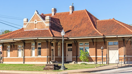
Nacogdoches on the map, United States
Where is located Nacogdoches
Exact location — Nacogdoches, Nacogdoches County, Texas, United States, marked on the map with a red marker.
Coordinates
Nacogdoches, United States coordinates in decimal format: latitude — 31.6035129, longitude — -94.6554874. When converted to degrees, minutes, seconds Nacogdoches has the following coordinates: 31°36′12.65 north latitude and -94°39′19.75 east longitude.
Population
Nacogdoches, Nacogdoches County, Texas, United States, according to our data the population is — 30,691 residents, which is about 0% of the total population of the country (United States).
Comparison of the population on the graph:
Exact time
Time zone for this location Nacogdoches — UTC -5 America/Chicago. Exact time — thursday, 4 april 2024 year, 23 h. 16 minutes.
Sunrise and sunset
Nacogdoches, sunrise and sunset data for a date — thursday 25.04.2024.
| Sunrise | Sunset | Day (duration) |
|---|---|---|
| 06:41 -1 minute | 19:51 -0 minutes | 13 h. 12 minutes. +1 minute |
You can control the scale of the map using the auxiliary tools to find out exactly where it is located Nacogdoches. When you change the scale of the map, the width of the ruler also changes (in kilometers and miles).
Nearby cities
The largest cities that are located nearby:
- Shreveport — 132 km
- Beaumont — 176 km
- Houston — 215 km
- Mesquite — 222 km
- Garland — 234 km
- Waco — 235 km
- Dallas — 238 km
- Richardson — 243 km
- Plano — 246 km
- Irving — 252 km
- Grand Prairie — 252 km
- Carrollton — 257 km
- Arlington — 260 km
- Frisco — 264 km
- Fort Worth — 279 km
- Denton — 290 km
- Lafayette — 294 km
- Killeen — 296 km
- Austin — 330 km
Distance to neighboring capitals:
- Mexico City
 (Mexico) — 1426 km
 - Belmopan
 (Belize) — 1703 km
 - Guatemala City
 (Guatemala) — 1936 km
 - Ottawa
 (Canada) — 2244 km
 - Nuuk
 (Greenland) — 4669 km
Attractions


Distance to the capital
Distance to the capital (Washington) is about — 1790 km.