Lone Pine — Charlotte Douglas International Airport
Lone Pine — Silver City
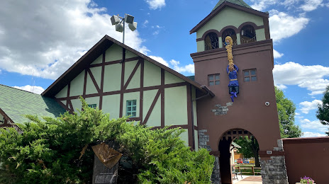
Lone Pine — Dutch Village
Lone Pine — Rothsay
Lone Pine — Tulsa
Lone Pine — Vermont
Lone Pine — Irving
Lone Pine — Harriston
Lone Pine — Wadesville
Lone Pine — Holladay
Lone Pine — Broward County
Lone Pine — Devens
Lone Pine — Allentown
Lone Pine — Tonkawa
Lone Pine — Oakdale
Lone Pine — Laramie
Lone Pine — Smoot
Lone Pine — Poway
Lone Pine — Drummond Airport
Bishop
Tonopah
Tonopah Airport
To me
Ely
Ely Airport
West Wendover
Wendover
Magna
Red Lion-Sheraton Hotel Heliport
Salt Lake City
Salt Lake City
Holladay
Park City
Coalville
Fort Bridger
Lyman
Rock Springs
Rawlins
Casper
Midwest
Gillette
Rozet
Moorcroft
Schloredt Airport
Spearfish
Whitewood
Sturgis
Summerset
Lone Pine — Charlotte Douglas International Airport
Lone Pine — Silver City
Lone Pine — Dutch Village
Lone Pine — Rothsay
Lone Pine — Tulsa
Lone Pine — Vermont
Lone Pine — Irving
Lone Pine — Harriston
Lone Pine — Wadesville
Lone Pine — Holladay
Lone Pine — Broward County
Lone Pine — Devens
Lone Pine — Allentown
Lone Pine — Tonkawa
Lone Pine — Oakdale
Lone Pine — Laramie
Lone Pine — Smoot
Lone Pine — Poway
Lone Pine — Drummond Airport
Bishop
Tonopah
Tonopah Airport
To me
Ely
Ely Airport
West Wendover
Wendover
Magna
Red Lion-Sheraton Hotel Heliport
Salt Lake City
Salt Lake City
Holladay
Park City
Coalville
Fort Bridger
Lyman
Rock Springs
Rawlins
Casper
Midwest
Gillette
Rozet
Moorcroft
Schloredt Airport
Spearfish
Whitewood
Sturgis
Summerset
Lone Pine — Rapid City distance, route on the map
Distance by car
Distance between Lone Pine, California, United States and Rapid City, South Dakota, United States by car is — km, or miles. To travel this distance by car, you need minute, or h.
Route on the map, driving directions
Car route Lone Pine — Rapid City was created automatically. The road on the map is shown as a blue line. By moving the markers, you can create a new route through the points you need.
Passing cities through which the car route passes: Independence, Bishop, Tonopah, Tonopah Airport, To me, Ely, Ely Airport, West Wendover, Wendover, Magna, Red Lion-Sheraton Hotel Heliport, Salt Lake City, Salt Lake City, Holladay, Park City, Coalville, Fort Bridger, Lyman, Rock Springs, Rawlins, Casper, Midwest, Gillette, Rozet, Moorcroft, Schloredt Airport, Spearfish, Whitewood, Sturgis, Summerset.
Distance by plane
If you decide to take a trip Lone Pine Rapid City by plane, then you have to fly the distance — 1504 km or 932 miles. It is marked on the map with a gray line (between two points in a straight line).
Flight time
Estimated flight time Lone Pine Rapid City by plane at cruising speed 750 km / h will be — 2 h.
Direction of movement
United States, Lone Pine — right-hand traffic. United States, Rapid City — right-hand traffic.
Difference in time
Lone Pine and Rapid City are in different time zones. The time difference is 1 hour (UTC -7 America/Los_Angeles, UTC -6 America/Denver).
Interesting Facts
Information on alternative ways to get to your destination.
The length of this distance is about 3.8% of the total length of the equator.
The percentage of the population is clearly shown in the graph:
Lone Pine — 1,607 (less by 60,281), Rapid City — 61,888 residents.
The cost of travel
Calculate the cost of the trip yourself using the fuel consumption calculator, changing the data in the table.