
 Tigery
Jouarre
Bost
Saint-Symphorien-le-Château
Hendaye
Barr
Albertville
Les Veys
La Celle
Vallet
Vimoutiers
Nemours
Honfleur
Aubry-du-Hainaut
Bressuire
Sarreguemines
Sauzet
Mortain
Gardanne
Tigery
Jouarre
Bost
Saint-Symphorien-le-Château
Hendaye
Barr
Albertville
Les Veys
La Celle
Vallet
Vimoutiers
Nemours
Honfleur
Aubry-du-Hainaut
Bressuire
Sarreguemines
Sauzet
Mortain
Gardanne
Montceau-les-Mines on the map, France
Where is located Montceau-les-Mines
Exact location — Montceau-les-Mines, Saône-et-Loire, Burgundy, France, marked on the map with a red marker.
Coordinates
Montceau-les-Mines, France coordinates in decimal format: latitude — 46.67413, longitude — 4.362979. When converted to degrees, minutes, seconds Montceau-les-Mines has the following coordinates: 46°40′26.87 north latitude and 4°21′46.72 east longitude.
Population
Montceau-les-Mines, Saône-et-Loire, Burgundy, France, according to our data the population is — 19,375 residents, which is about 0% of the total population of the country (France).
Comparison of the population on the graph:
Exact time
Time zone for this location Montceau-les-Mines — UTC +2 Europe/Paris. Exact time — saturday, 5 may 2024 year, 10 h. 15 minutes.
Sunrise and sunset
Montceau-les-Mines, sunrise and sunset data for a date — saturday 11.05.2024.
| Sunrise | Sunset | Day (duration) |
|---|---|---|
| 06:16 -1 minute | 21:01 +1 minute | 14 h. 48 minutes. +2 minutes |
You can control the scale of the map using the auxiliary tools to find out exactly where it is located Montceau-les-Mines. When you change the scale of the map, the width of the ruler also changes (in kilometers and miles).
Nearby cities
The largest cities that are located nearby:
- Dijon — 88 km
- Lyon — 107 km
- Villeurbanne — 108 km
- Saint-Étienne — 136 km
- Besançon — 139 km
- Clermont-Ferrand — 140 km
- Geneva
 (Switzerland) — 146 km
 - Lausanne (Switzerland) — 174 km
- Grenoble — 196 km
- Orléans — 227 km
- Bern (Switzerland) — 235 km
- Mulhouse — 251 km
- Limoges — 256 km
- Nancy — 260 km
- Basel (Switzerland) — 261 km
- Boulogne-Billancourt — 285 km
- Tours — 287 km
- Reims — 287 km
- Freiburg
 (Germany) — 296 km
Distance to neighboring capitals:
- Bern (Switzerland) — 237 km
- Vaduz
 (Liechtenstein) — 395 km
 - Brussels
 (Belgium) — 465 km
 - Andorra la Vella
 (Andorra) — 515 km
 - London
 (United Kingdom) — 629 km
 - Amsterdam
 (Netherlands) — 635 km
 - Prague
 (Czech Republic) — 834 km
 - Rome
 (Italy) — 836 km
 - Berlin (Germany) — 919 km
- Vienna
 (Austria) — 919 km
 - Madrid
 (Spain) — 952 km
 - Copenhagen
 (Denmark) — 1151 km
 - Warsaw
 (Poland) — 1349 km
 - Lisbon
 (Portugal) — 1411 km
 - Nicosia
 — 2731 km
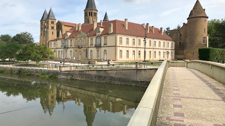
Attractions
Distance to the capital
Distance to the capital (Paris) is about — 286 km.