Guadalupe — Súchil
Guadalupe — La Laja
Guadalupe — Felipe Carrillo Puerto
Guadalupe — Santa María Jalapa del Marqués
Guadalupe — Ciudad Guzmán
Guadalupe — Hoctún
Guadalupe — Ciudad Madero
Guadalupe — Chimalhuacan
Guadalupe — San Juan
Guadalupe — La Perla
Guadalupe — Ixtepec
Guadalupe — Centro Cívico
Guadalupe — Minatitlan International Airport
Guadalupe — Chávez Talamantes
Guadalupe — Puerto Arista
Guadalupe — La Noria
Guadalupe — Jaral del Progreso
Guadalupe — El Refugio
Guadalupe — La Ballena
Villa de Cos
Concepción del Oro Municipality
Saltillo
Saltillo
Saltillo
Ramos Arizpe
Aeropuerto Saltillo “Plan de Guadalupe”
Santa Catarina
Santa Catarina
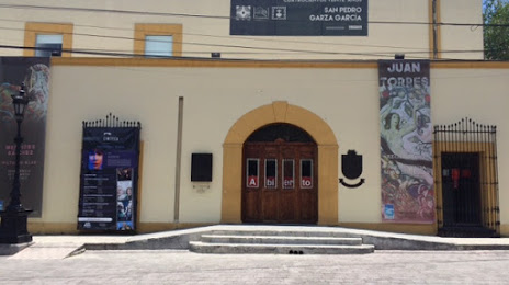
San Pedro Garza García
Guadalupe — Súchil
Guadalupe — La Laja
Guadalupe — Felipe Carrillo Puerto
Guadalupe — Santa María Jalapa del Marqués
Guadalupe — Ciudad Guzmán
Guadalupe — Hoctún
Guadalupe — Ciudad Madero
Guadalupe — Chimalhuacan
Guadalupe — San Juan
Guadalupe — La Perla
Guadalupe — Ixtepec
Guadalupe — Centro Cívico
Guadalupe — Minatitlan International Airport
Guadalupe — Chávez Talamantes
Guadalupe — Puerto Arista
Guadalupe — La Noria
Guadalupe — Jaral del Progreso
Guadalupe — El Refugio
Guadalupe — La Ballena
Villa de Cos
Concepción del Oro Municipality
Saltillo
Saltillo
Saltillo
Ramos Arizpe
Aeropuerto Saltillo “Plan de Guadalupe”
Santa Catarina
Santa Catarina
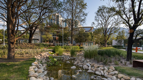
San Pedro Garza García
Guadalupe — San Pedro Garza García distance, route on the map
Distance by car
Distance between Guadalupe, Zacatecas, Mexico and San Pedro Garza García, Nuevo León, Mexico by car is — km, or miles. To travel this distance by car, you need minute, or h.
Route on the map, driving directions
Car route Guadalupe — San Pedro Garza García was created automatically. The road on the map is shown as a blue line. By moving the markers, you can create a new route through the points you need.
Passing cities through which the car route passes: De Guerreros, Villa de Cos, Concepción del Oro Municipality, Saltillo, Saltillo, Saltillo, Ramos Arizpe, Aeropuerto Saltillo “Plan de Guadalupe”, Santa Catarina, Santa Catarina, San Pedro Garza García.
Distance by plane
If you decide to take a trip Guadalupe San Pedro Garza García by plane, then you have to fly the distance — 388 km or 241 miles. It is marked on the map with a gray line (between two points in a straight line).
Flight time
Estimated flight time Guadalupe San Pedro Garza García by plane at cruising speed 750 km / h will be — 31 min.
Direction of movement
Mexico, Guadalupe — right-hand traffic. Mexico, San Pedro Garza García — right-hand traffic.
Difference in time
Guadalupe and San Pedro Garza García are in the same time zone. Between them there is no time difference (UTC -6 America/Mexico_City).
Interesting Facts
Information on alternative ways to get to your destination.
The length of this distance is about 1.0% of the total length of the equator.
The percentage of the population is clearly shown in the graph:
Guadalupe — 94,089 (less by 27,920), San Pedro Garza García — 122,009 residents.
The cost of travel
Calculate the cost of the trip yourself using the fuel consumption calculator, changing the data in the table.