Ciudad Hidalgo — La Libertad
Ciudad Hidalgo — Villa Corona
Ciudad Hidalgo — Loma Linda
Ciudad Hidalgo — Acolman
Ciudad Hidalgo — El Sauz
Ciudad Hidalgo — Cuauhtémoc
Ciudad Hidalgo — San Pedro Garza García
Ciudad Hidalgo — Yecapixtla
Ciudad Hidalgo — Mazapil
Ciudad Hidalgo — Atitalaquía
Ciudad Hidalgo — La Venta del Astillero
Ciudad Hidalgo — Puerto de Buenavista
Ciudad Hidalgo — Las Margaritas
Ciudad Hidalgo — Uzeta
Ciudad Hidalgo — San Andrés Larráinzar
Ciudad Hidalgo — Escuintla
Ciudad Hidalgo — Chilpancingo
Ciudad Hidalgo — Tekpan
Ciudad Hidalgo — Ocampo
Tuxtla Chico
Tapachula
Huehuetán
Huixtla
Escuintla
Acacoyagua
Mapastepec
Pijijiapan
Gustavo López Gutiérrez
General Alberto Pineda
Tonalá
El Otatal
Arriaga
Arriaga
A Nicolás Bravo
Guadalupe
Chahuites
San Pedro Tapanatepec
Santo Domingo Zanatepec
Santiago Niltepec
Santo Domingo Ingenio
La Ventosa
Mazahua
Lagunas
Matias Romero Avendano
Matías Romero
Mogoñé
Boca del Monte
Palomares
Ubero
Jesús Carranza
Colonia Villa Alta
Sayula de Alemán
Nopalapan
Los Cocos
Cosamaloapan
La Tinaja
Jamapa
El Tejar
Veracruz International Airport
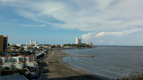
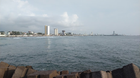
Heroica Veracruz
Costa Verde
Ciudad Hidalgo — La Libertad
Ciudad Hidalgo — Villa Corona
Ciudad Hidalgo — Loma Linda
Ciudad Hidalgo — Acolman
Ciudad Hidalgo — El Sauz
Ciudad Hidalgo — Cuauhtémoc
Ciudad Hidalgo — San Pedro Garza García
Ciudad Hidalgo — Yecapixtla
Ciudad Hidalgo — Mazapil
Ciudad Hidalgo — Atitalaquía
Ciudad Hidalgo — La Venta del Astillero
Ciudad Hidalgo — Puerto de Buenavista
Ciudad Hidalgo — Las Margaritas
Ciudad Hidalgo — Uzeta
Ciudad Hidalgo — San Andrés Larráinzar
Ciudad Hidalgo — Escuintla
Ciudad Hidalgo — Chilpancingo
Ciudad Hidalgo — Tekpan
Ciudad Hidalgo — Ocampo
Tuxtla Chico
Tapachula
Huehuetán
Huixtla
Escuintla
Acacoyagua
Mapastepec
Pijijiapan
Gustavo López Gutiérrez
General Alberto Pineda
Tonalá
El Otatal
Arriaga
Arriaga
A Nicolás Bravo
Guadalupe
Chahuites
San Pedro Tapanatepec
Santo Domingo Zanatepec
Santiago Niltepec
Santo Domingo Ingenio
La Ventosa
Mazahua
Lagunas
Matias Romero Avendano
Matías Romero
Mogoñé
Boca del Monte
Palomares
Ubero
Jesús Carranza
Colonia Villa Alta
Sayula de Alemán
Nopalapan
Los Cocos
Cosamaloapan
La Tinaja
Jamapa
El Tejar
Veracruz International Airport
Heroica Veracruz
Costa Verde
Ciudad Hidalgo — Boca del Río distance, route on the map
Distance by car
Distance between Ciudad Hidalgo, Chiapas, Mexico and Boca del Río, Veracruz, Mexico by car is — km, or miles. To travel this distance by car, you need minute, or h.
Route on the map, driving directions
Car route Ciudad Hidalgo — Boca del Río was created automatically. The road on the map is shown as a blue line. By moving the markers, you can create a new route through the points you need.
Passing cities through which the car route passes: Delight, Tuxtla Chico, Tapachula, Huehuetán, Huixtla, Escuintla, Acacoyagua, Mapastepec, Pijijiapan, Gustavo López Gutiérrez, General Alberto Pineda, Tonalá, El Otatal, Arriaga, Arriaga, A Nicolás Bravo, Guadalupe, Chahuites, San Pedro Tapanatepec, Santo Domingo Zanatepec, Santiago Niltepec, Santo Domingo Ingenio, La Ventosa, Mazahua, Lagunas, Matias Romero Avendano, Matías Romero, Mogoñé, Boca del Monte, Palomares, Ubero, Jesús Carranza, Colonia Villa Alta, Sayula de Alemán, Nopalapan, Los Cocos, Cosamaloapan, La Tinaja, Jamapa, El Tejar, Veracruz International Airport, Heroica Veracruz, Costa Verde.
Distance by plane
If you decide to take a trip Ciudad Hidalgo Boca del Río by plane, then you have to fly the distance — 648 km or 402 miles. It is marked on the map with a gray line (between two points in a straight line).
Flight time
Estimated flight time Ciudad Hidalgo Boca del Río by plane at cruising speed 750 km / h will be — 51 min.
Direction of movement
Mexico, Ciudad Hidalgo — right-hand traffic. Mexico, Boca del Río — right-hand traffic.
Difference in time
Ciudad Hidalgo and Boca del Río are in the same time zone. Between them there is no time difference (UTC -6 America/Mexico_City).
Interesting Facts
Information on alternative ways to get to your destination.
The length of this distance is about 1.6% of the total length of the equator.
The cost of travel
Calculate the cost of the trip yourself using the fuel consumption calculator, changing the data in the table.