Tamazunchale — Macuspana
Tamazunchale — Ciudad Guadalupe Victoria
Tamazunchale — Chapala
Tamazunchale — Costa Verde
Tamazunchale — Cerralvo Municipality
Tamazunchale — Oxkutzcab Municipality
Tamazunchale — Real de Catorce
Tamazunchale — Jiquilpan
Tamazunchale — Texcalyacac
Tamazunchale — Gen. y Lic. Ignacio López Rayón International Airport
Tamazunchale — Angostura
Tamazunchale — Corregidora
Tamazunchale — Tecario
Tamazunchale — Luis Moya
Tamazunchale — Chapala
Tamazunchale — Reforma de Pineda
Tamazunchale — San Carlos Nuevo Guaymas
Tamazunchale — Reform
Tamazunchale — San Bartolo
Zimapan
Zimapan
Tasquillo
Ixmiquilpan
Ixmiquilpan
Xochitlán
Progreso
Mixquiahuala
Tezontepec de Aldama
Tlahuelilpan
Tlaxcoapan
Tula
Tula
Tepeji de Ocampo
Huehuetoca
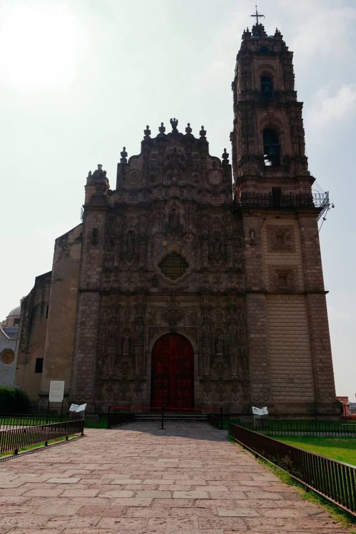
Tamazunchale — Tepotzotlán distance, route on the map
Distance by car
Distance between Tamazunchale, San Luis Potosi, Mexico and Tepotzotlán, Estado de México, Mexico by car is — km, or miles. To travel this distance by car, you need minute, or h.
Route on the map, driving directions
Car route Tamazunchale — Tepotzotlán was created automatically. The road on the map is shown as a blue line. By moving the markers, you can create a new route through the points you need.
Passing cities through which the car route passes: Chapulhuacán, Zimapan, Zimapan, Tasquillo, Ixmiquilpan, Ixmiquilpan, Xochitlán, Progreso, Mixquiahuala, Tezontepec de Aldama, Tlahuelilpan, Tlaxcoapan, Tula, Tula, Tepeji de Ocampo, Huehuetoca.
Distance by plane
If you decide to take a trip Tamazunchale Tepotzotlán by plane, then you have to fly the distance — 177 km or 110 miles. It is marked on the map with a gray line (between two points in a straight line).
Flight time
Estimated flight time Tamazunchale Tepotzotlán by plane at cruising speed 750 km / h will be — 14 min.
Direction of movement
Mexico, Tamazunchale — right-hand traffic. Mexico, Tepotzotlán — right-hand traffic.
Difference in time
Tamazunchale and Tepotzotlán are in the same time zone. Between them there is no time difference (UTC -6 America/Mexico_City).
Interesting Facts
Information on alternative ways to get to your destination.
The length of this distance is about 0.4% of the total length of the equator.
The percentage of the population is clearly shown in the graph:
Tamazunchale — 21,532 (less by 22,987), Tepotzotlán — 44,519 residents.
The cost of travel
Calculate the cost of the trip yourself using the fuel consumption calculator, changing the data in the table.