Wola Mrokowska — Czerwonka
Wola Mrokowska — Giżycko County
Wola Mrokowska — Łabiszyn
Wola Mrokowska — Nowy Targ
Wola Mrokowska — Wasilków
Wola Mrokowska — Bohutyn
Wola Mrokowska — Szydłów
Wola Mrokowska — Chybie
Wola Mrokowska — Ostroleka
Wola Mrokowska — Gmina Siepraw
Wola Mrokowska — Paprotnia
Wola Mrokowska — Gryfów Śląski
Wola Mrokowska — Pszczółki
Wola Mrokowska — Otwock
Wola Mrokowska — Gogołów
Wola Mrokowska — Kalisz Pomorski
Wola Mrokowska — Minty
Wola Mrokowska — Borek Wielkopolski
Wola Mrokowska — Kamiennik
Wólka Kosowska
Sękocin Nowy
Raszyn
Warsaw Chopin Airport
Warsaw
IBEX-U.L. Sp. o.o. / Air services
Bielany
Łomianki
Skierdy
Czosnów
Nowy Dwór Mazowiecki
Warsaw Modlin Airport
Zakroczym
Janowo
Załuski
Krysk
Plonsk
Milewo
Baboszewo
Glinojeck
Strzegowo
Wiśniewo
Mlawa
Wieczfnia Kościelna
Wola
Janowiec Kościelny
Tatary
Fridays
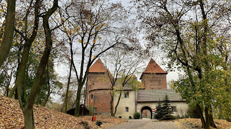
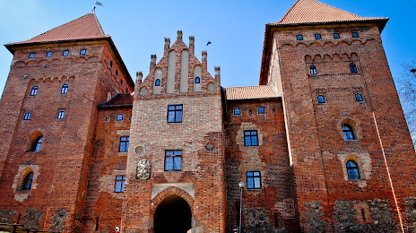
Wola Mrokowska — Nidzica distance, route on the map
Distance by car
Distance between Wola Mrokowska, Masovian Voivodeship, Poland and Nidzica, Warmian-Masurian Voivodeship, Poland by car is — km, or miles. To travel this distance by car, you need minute, or h.
Route on the map, driving directions
Car route Wola Mrokowska — Nidzica was created automatically. The road on the map is shown as a blue line. By moving the markers, you can create a new route through the points you need.
Passing cities through which the car route passes: Mroków, Wólka Kosowska, Sękocin Nowy, Raszyn, Warsaw Chopin Airport, Warsaw, IBEX-U.L. Sp. o.o. / Air services, Bielany, Łomianki, Skierdy, Czosnów, Nowy Dwór Mazowiecki, Warsaw Modlin Airport, Zakroczym, Janowo, Załuski, Krysk, Plonsk, Milewo, Baboszewo, Glinojeck, Strzegowo, Wiśniewo, Mlawa, Wieczfnia Kościelna, Wola, Janowiec Kościelny, Tatary, Fridays.
Distance by plane
If you decide to take a trip Wola Mrokowska Nidzica by plane, then you have to fly the distance — 151 km or 94 miles. It is marked on the map with a gray line (between two points in a straight line).
Flight time
Estimated flight time Wola Mrokowska Nidzica by plane at cruising speed 750 km / h will be — 12 min.
Direction of movement
Poland, Wola Mrokowska — right-hand traffic. Poland, Nidzica — right-hand traffic.
Difference in time
Wola Mrokowska and Nidzica are in the same time zone. Between them there is no time difference (UTC +2 Europe/Warsaw).
Interesting Facts
Information on alternative ways to get to your destination.
The length of this distance is about 0.4% of the total length of the equator.
The cost of travel
Calculate the cost of the trip yourself using the fuel consumption calculator, changing the data in the table.