Itaigara
Curral Alto
Rio Branco
Lençóis
Fortaleza
Manicoré
Apucarana
Capão Alto
São João do Itaperiú
Barreiro
Jaraguá
Maciel
Linhares
São Sebastião do Maranhão
Lavras
João Pessoa
Comodoro
Bairro Novo
Amapá
Itaigara
Curral Alto
Rio Branco
Lençóis
Fortaleza
Manicoré
Apucarana
Capão Alto
São João do Itaperiú
Barreiro
Jaraguá
Maciel
Linhares
São Sebastião do Maranhão
Lavras
João Pessoa
Comodoro
Bairro Novo
Amapá
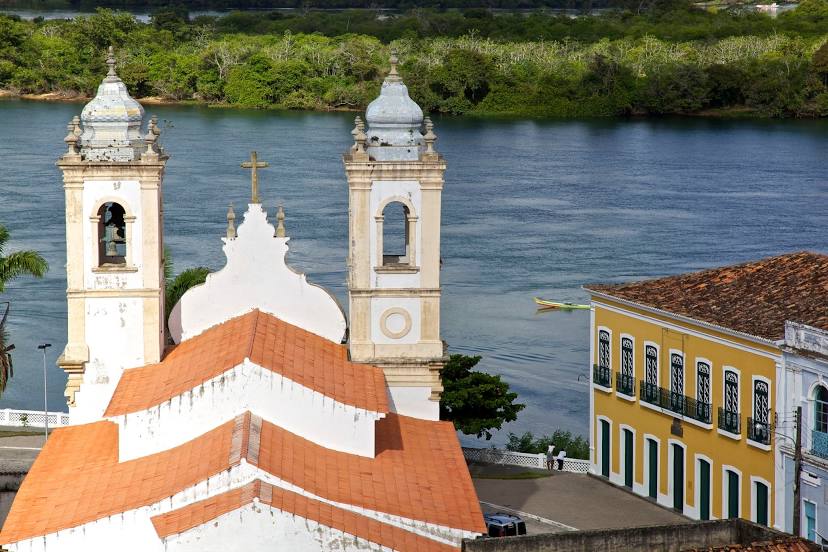
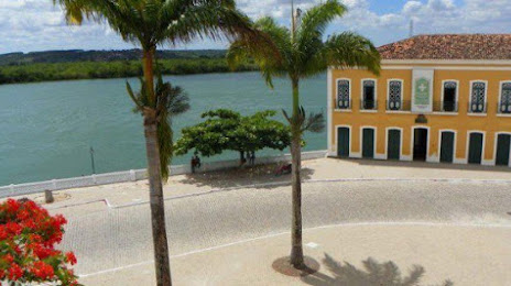
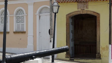
Penedo on the map, Brazil
Where is located Penedo
Exact location — Penedo, Penedo, Alagoas, Brazil, marked on the map with a red marker.
Coordinates
Penedo, Brazil coordinates in decimal format: latitude — -10.2889626, longitude — -36.5839256. When converted to degrees, minutes, seconds Penedo has the following coordinates: -10°17′20.27 north latitude and -36°35′2.13 east longitude.
Population
Penedo, Penedo, Alagoas, Brazil, according to our data the population is — 42,097 residents, which is about 0% of the total population of the country (Brazil).
Comparison of the population on the graph:
Exact time
Time zone for this location Penedo — UTC -3 America/Fortaleza. Exact time — saturday, 4 april 2024 year, 16 h. 24 minutes.
Sunrise and sunset
Penedo, sunrise and sunset data for a date — saturday 27.04.2024.
| Sunrise | Sunset | Day (duration) |
|---|---|---|
| 05:33 -0 minutes | 17:14 -0 minutes | 11 h. 42 minutes. -0 minutes |
You can control the scale of the map using the auxiliary tools to find out exactly where it is located Penedo. When you change the scale of the map, the width of the ruler also changes (in kilometers and miles).
Nearby cities
The largest cities that are located nearby:
- Arapiraca — 60 km
- Aracaju — 90 km
- Maceió — 119 km
- Caruaru — 232 km
- Alagoinhas — 285 km
- Jaboatão dos Guararapes — 291 km
- Camaragibe — 306 km
- Recife — 309 km
- Camaçari — 326 km
- Feira de Santana — 337 km
- Lauro de Freitas — 342 km
- Campina Grande — 348 km
- Salvador — 362 km
- Santa Rita — 391 km
- João Pessoa — 399 km
- Petrolina — 439 km
- Juazeiro do Norte — 452 km
- Parnamirim — 505 km
- Natal — 521 km
Distance to neighboring capitals:
- Paramaribo
 (Suriname) — 2734 km
 - Asuncion
 (Paraguay) — 2770 km
 - Asuncion (Paraguay) — 2777 km
- Georgetown
 (Guyana) — 3054 km
 - Montevideo
 (Uruguay) — 3382 km
 - Nuestra Señora de La Paz
 (Bolivia) — 3480 km
 - Buenos Aires
 (Argentina) — 3494 km
 - Caracas
 (Venezuela) — 4077 km
 - Santiago
 (Chile) — 4323 km
 - Bogota
 (Colombia) — 4471 km
 - Quito
 (Ecuador) — 4767 km