Barra Grande
Penedo
Penedo
Itacaré
Charqueada
Espumoso
Centro
Cooperativa
Nazaré
Amaral Ferrador
Augusto Pestana
Matriz
Canela
Camanducaia
Santos
Araraquara
Seringal Tamacuro
Garapuava
Cunha Porã
Barra Grande
Penedo
Penedo
Itacaré
Charqueada
Espumoso
Centro
Cooperativa
Nazaré
Amaral Ferrador
Augusto Pestana
Matriz
Canela
Camanducaia
Santos
Araraquara
Seringal Tamacuro
Garapuava
Cunha Porã
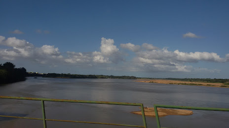
Linhares on the map, Brazil
Where is located Linhares
Exact location — Linhares, State of Espírito Santo, Brazil, marked on the map with a red marker.
Coordinates
Linhares, Brazil coordinates in decimal format: latitude — -19.3946651, longitude — -40.0652641. When converted to degrees, minutes, seconds Linhares has the following coordinates: -19°23′40.79 north latitude and -40°3′54.95 east longitude.
Population
Linhares, State of Espírito Santo, Brazil, according to our data the population is — 105,075 residents, which is about 0% of the total population of the country (Brazil).
Comparison of the population on the graph:
Exact time
Time zone for this location Linhares — UTC -3 America/Sao_Paulo. Exact time — monday, 4 april 2024 year, 15 h. 09 minutes.
Sunrise and sunset
Linhares, sunrise and sunset data for a date — monday 29.04.2024.
| Sunrise | Sunset | Day (duration) |
|---|---|---|
| 05:57 -0 minutes | 17:17 -1 minute | 11 h. 18 minutes. -1 minute |
You can control the scale of the map using the auxiliary tools to find out exactly where it is located Linhares. When you change the scale of the map, the width of the ruler also changes (in kilometers and miles).
Nearby cities
The largest cities that are located nearby:
- Colatina — 65 km
- Serra — 84 km
- Cariacica — 103 km
- Vila Velha — 108 km
- Guarapari — 148 km
- Cachoeiro de Itapemirim — 194 km
- Valadares Governor — 207 km
- Teófilo Otoni — 228 km
- Coronel Fabriciano — 267 km
- Porto Seguro — 343 km
- Macaé — 374 km
- Sabará — 395 km
- Santa Luzia — 405 km
- Belo Horizonte — 406 km
- Ribeirão das Neves — 420 km
- Ibirité — 421 km
- Contagem — 421 km
- Juiz de Fora — 426 km
- Esmeraldas — 431 km
Distance to neighboring capitals:
- Asuncion
 (Paraguay) — 1914 km
 - Asuncion (Paraguay) — 1920 km
- Montevideo
 (Uruguay) — 2341 km
 - Buenos Aires
 (Argentina) — 2473 km
 - Nuestra Señora de La Paz
 (Bolivia) — 2986 km
 - Paramaribo
 (Suriname) — 3261 km
 - Santiago
 (Chile) — 3405 km
 - Georgetown
 (Guyana) — 3524 km
 - Caracas
 (Venezuela) — 4443 km
 - Bogota
 (Colombia) — 4579 km
 - Quito
 (Ecuador) — 4699 km