
 Coria
Campollo
Vilanova del Vallès
Vilardida
Cáñar
Somaén
Capdesaso
A Coruña Airport
Cardedeu
Region of Murcia
Zorita de los Canes
Cabrils
Islantilla
Miota
Sotres
Vilamaior
Figueiroa
La Iglesuela
Mohedas de la Jara
Coria
Campollo
Vilanova del Vallès
Vilardida
Cáñar
Somaén
Capdesaso
A Coruña Airport
Cardedeu
Region of Murcia
Zorita de los Canes
Cabrils
Islantilla
Miota
Sotres
Vilamaior
Figueiroa
La Iglesuela
Mohedas de la Jara
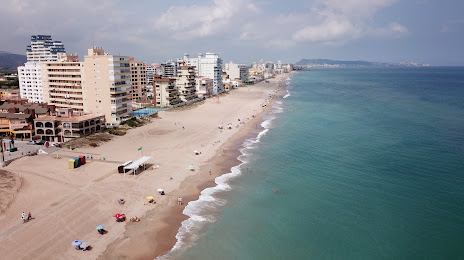
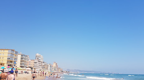
Tavernes de la Valldigna on the map, Spain
Where is located Tavernes de la Valldigna
Exact location — Valencia, Valencian Community, Spain, marked on the map with a red marker.
Coordinates
Tavernes de la Valldigna, Spain coordinates in decimal format: latitude — 39.0733815, longitude — -0.2643516. When converted to degrees, minutes, seconds Tavernes de la Valldigna has the following coordinates: 39°4′24.17 north latitude and -0°15′51.67 east longitude.
Population
Valencia, Valencian Community, Spain, according to our data the population is — 18,195 residents, which is about 0% of the total population of the country (Spain).
Comparison of the population on the graph:
Exact time
Time zone for this location Tavernes de la Valldigna — UTC +2 Europe/Madrid. Exact time — thursday, 5 may 2024 year, 10 h. 07 minutes.
Sunrise and sunset
Tavernes de la Valldigna, sunrise and sunset data for a date — thursday 16.05.2024.
| Sunrise | Sunset | Day (duration) |
|---|---|---|
| 06:49 -1 minute | 21:04 -0 minutes | 14 h. 18 minutes. +1 minute |
You can control the scale of the map using the auxiliary tools to find out exactly where it is located Tavernes de la Valldigna. When you change the scale of the map, the width of the ruler also changes (in kilometers and miles).
Nearby cities
The largest cities that are located nearby:
- Valencia — 45 km
- Albacete — 137 km
- Murcia — 141 km
- Cartagena — 172 km
- Palma — 254 km
- Tarragona — 259 km
- Zaragoza — 289 km
- Lleida — 291 km
- Alcala de Henares — 304 km
- Torrejón de Ardoz — 310 km
- Almería — 315 km
- L'Hospitalet de Llobregat — 321 km
- Getafe — 323 km
- Alcobendas — 326 km
- Leganés — 326 km
- Fuenlabrada — 327 km
- Alcorcón — 332 km
- Santa Coloma de Gramenet — 333 km
- Terrassa — 333 km
Distance to neighboring capitals:
- Andorra la Vella
 (Andorra) — 410 km
 - Lisbon
 (Portugal) — 769 km
 - Rabat
 (Morocco) — 817 km
 - Paris
 (France) — 1108 km
 - Paris (France) — 1108 km
Attractions
Distance to the capital
Distance to the capital (Madrid) is about — 330 km.