
 La Nou de Berguedà
Cruïlles, Monells i Sant Sadurní de l'Heura
As Pontes de García Rodríguez
Pelayos
Rivabellosa
Villamayor
Valdeavellano de Tera
Barcia
Lobios
Puerto de Mogán
Tavernes de la Valldigna
Vilar de Infesta
Los Caños de Meca
Cadalso de los Vidrios
Morañó
Esteiro
Barcelona
Colmenar
Trones
La Nou de Berguedà
Cruïlles, Monells i Sant Sadurní de l'Heura
As Pontes de García Rodríguez
Pelayos
Rivabellosa
Villamayor
Valdeavellano de Tera
Barcia
Lobios
Puerto de Mogán
Tavernes de la Valldigna
Vilar de Infesta
Los Caños de Meca
Cadalso de los Vidrios
Morañó
Esteiro
Barcelona
Colmenar
Trones
Coria on the map, Spain
Where is located Coria
Exact location — Cáceres, Extremadura, Spain, marked on the map with a red marker.
Coordinates
Coria, Spain coordinates in decimal format: latitude — 39.9880324, longitude — -6.5369786. When converted to degrees, minutes, seconds Coria has the following coordinates: 39°59′16.92 north latitude and -6°32′13.12 east longitude.
Population
Cáceres, Extremadura, Spain, according to our data the population is — 12,896 residents, which is about 0% of the total population of the country (Spain).
Comparison of the population on the graph:
Exact time
Time zone for this location Coria — UTC +2 Europe/Madrid. Exact time — sunday, 5 may 2024 year, 15 h. 28 minutes.
Sunrise and sunset
Coria, sunrise and sunset data for a date — sunday 5.05.2024.
| Sunrise | Sunset | Day (duration) |
|---|---|---|
| 07:23 -2 minutes | 21:21 +1 minute | 14 h. 0 minutes. +3 minutes |
You can control the scale of the map using the auxiliary tools to find out exactly where it is located Coria. When you change the scale of the map, the width of the ruler also changes (in kilometers and miles).
Nearby cities
The largest cities that are located nearby:
- Badajoz — 128 km
- Salamanca — 131 km
- Coimbra
 (Portugal) — 160 km
 - Porto (Portugal) — 217 km
- Móstoles — 228 km
- Alcorcón — 232 km
- Braga (Portugal) — 233 km
- Fuenlabrada — 233 km
- Leganés — 236 km
- Valladolid — 237 km
- Getafe — 239 km
- Alcobendas — 251 km
- Torrejón de Ardoz — 263 km
- Lisbon (Portugal) — 265 km
- Amadora (Portugal) — 269 km
- Queluz (Portugal) — 271 km
- Alcala de Henares — 272 km
- Córdoba — 278 km
- Ourense — 281 km
Distance to neighboring capitals:
- Lisbon (Portugal) — 264 km
- Rabat
 (Morocco) — 670 km
 - Andorra la Vella
 (Andorra) — 729 km
 - Paris
 (France) — 1211 km
 - Paris (France) — 1211 km
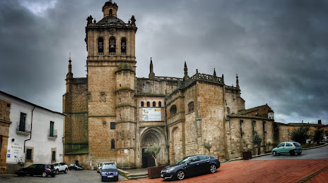
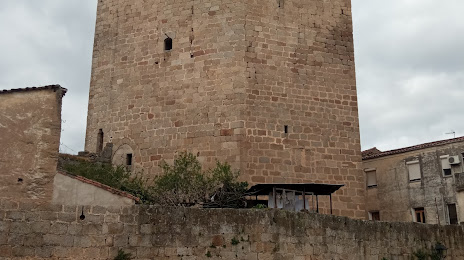
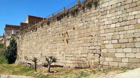
Attractions

Distance to the capital
Distance to the capital (Madrid) is about — 245 km.