Rosa Zárate — Cañar Province
Rosa Zárate — Boyaca
Rosa Zárate — Orianga
Rosa Zárate — Gualaceo
Rosa Zárate — Yantzaza
Rosa Zárate — Chaquinal
Rosa Zárate — Junquillal
Rosa Zárate — Pichincha
Rosa Zárate — Cochancay
Rosa Zárate — Chiguinda
Rosa Zárate — San Jacinto de Buena Fe
Rosa Zárate — San Lucas
Rosa Zárate — Pincho
Rosa Zárate — Santiago
Rosa Zárate — Simon Bolivar
Rosa Zárate — Peñaherrera
Rosa Zárate — Puyo
Rosa Zárate — Déleg
Rosa Zárate — Guayquichuma
Esmeraldas
La Independencia
La Concordia
Puerto Quito
Pichincha
Pedro Vicente Maldonado
San Miguel de Los Bancos
Mindo
Tandayapa
Nanegalito
Alaspungo
Calacalí
San Antonio
Pomasqui
D
Comite del Pueblo
Calderon
Mariscal Sucre International Airport
Guayllabamba
Malchinguí
Santa Rosa de Cusubamba
Tabacundo
Tabacundo
Pijal
Gonzalez Suarez
San Rafael
Eugenio Espejo
Otavalo
Otavalo
Ilumán
Atuntaqui
Atuntaqui
Ecuador
San Antonio de Ibarra
Imbabura Province
Rosa Zárate — Cañar Province
Rosa Zárate — Boyaca
Rosa Zárate — Orianga
Rosa Zárate — Gualaceo
Rosa Zárate — Yantzaza
Rosa Zárate — Chaquinal
Rosa Zárate — Junquillal
Rosa Zárate — Pichincha
Rosa Zárate — Cochancay
Rosa Zárate — Chiguinda
Rosa Zárate — San Jacinto de Buena Fe
Rosa Zárate — San Lucas
Rosa Zárate — Pincho
Rosa Zárate — Santiago
Rosa Zárate — Simon Bolivar
Rosa Zárate — Peñaherrera
Rosa Zárate — Puyo
Rosa Zárate — Déleg
Rosa Zárate — Guayquichuma
Esmeraldas
La Independencia
La Concordia
Puerto Quito
Pichincha
Pedro Vicente Maldonado
San Miguel de Los Bancos
Mindo
Tandayapa
Nanegalito
Alaspungo
Calacalí
San Antonio
Pomasqui
D
Comite del Pueblo
Calderon
Mariscal Sucre International Airport
Guayllabamba
Malchinguí
Santa Rosa de Cusubamba
Tabacundo
Tabacundo
Pijal
Gonzalez Suarez
San Rafael
Eugenio Espejo
Otavalo
Otavalo
Ilumán
Atuntaqui
Atuntaqui
Ecuador
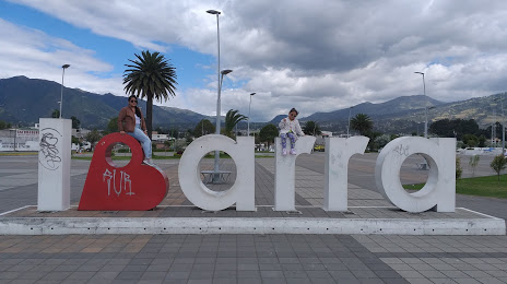
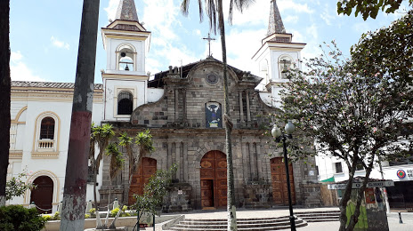
San Antonio de Ibarra
Imbabura Province
Rosa Zárate — Ibarra distance, route on the map
Distance by car
Distance between Rosa Zárate, Esmeraldas Province, Ecuador and Ibarra, Imbabura, Ecuador by car is — km, or miles. To travel this distance by car, you need minute, or h.
Route on the map, driving directions
Car route Rosa Zárate — Ibarra was created automatically. The road on the map is shown as a blue line. By moving the markers, you can create a new route through the points you need.
Passing cities through which the car route passes: Esmeraldas Province, Esmeraldas, La Independencia, La Concordia, Puerto Quito, Pichincha, Pedro Vicente Maldonado, San Miguel de Los Bancos, Mindo, Tandayapa, Nanegalito, Alaspungo, Calacalí, San Antonio, Pomasqui, D, Comite del Pueblo, Calderon, Mariscal Sucre International Airport, Guayllabamba, Malchinguí, Santa Rosa de Cusubamba, Tabacundo, Tabacundo, Pijal, Gonzalez Suarez, San Rafael, Eugenio Espejo, Otavalo, Otavalo, Ilumán, Atuntaqui, Atuntaqui, Ecuador, San Antonio de Ibarra, Imbabura Province.
Distance by plane
If you decide to take a trip Rosa Zárate Ibarra by plane, then you have to fly the distance — 149 km or 92 miles. It is marked on the map with a gray line (between two points in a straight line).
Flight time
Estimated flight time Rosa Zárate Ibarra by plane at cruising speed 750 km / h will be — 11 min.
Direction of movement
Ecuador, Rosa Zárate — right-hand traffic. Ecuador, Ibarra — right-hand traffic.
Difference in time
Rosa Zárate and Ibarra are in the same time zone. Between them there is no time difference (UTC -5 America/Guayaquil).
Interesting Facts
Information on alternative ways to get to your destination.
The length of this distance is about 0.4% of the total length of the equator.
The percentage of the population is clearly shown in the graph:
Rosa Zárate — 42,121 (less by 66,545), Ibarra — 108,666 residents.
The cost of travel
Calculate the cost of the trip yourself using the fuel consumption calculator, changing the data in the table.