Ponta Grossa — Rosário do Ivaí
Ponta Grossa — Dias d'Ávila
Ponta Grossa — Belmonte
Ponta Grossa — Iporá
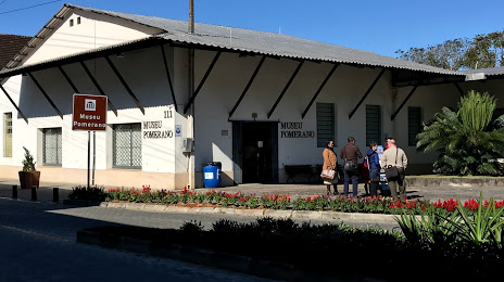
Ponta Grossa — Morro Reuter
Ponta Grossa — Armação dos Búzios
Ponta Grossa — Canto do Buriti
Ponta Grossa — Itaocara
Ponta Grossa — Fernando Prestes
Ponta Grossa — Bagé
Ponta Grossa — São Lourenço da Serra
Ponta Grossa — Astorga
Ponta Grossa — Amambai
Ponta Grossa — Campo Novo
Ponta Grossa — Goianápolis
Ponta Grossa — Mirandópolis
Ponta Grossa — Herculândia
Ponta Grossa — Fuzil
Ponta Grossa — Barra do Corda
Campo Magro
Fazenda Rio Grande
Mandirituba
Agudos do Sul
São Bento do Sul
Jaraguá do Sul
Ponta Grossa — Rosário do Ivaí
Ponta Grossa — Dias d'Ávila
Ponta Grossa — Belmonte
Ponta Grossa — Iporá
Ponta Grossa — Morro Reuter
Ponta Grossa — Armação dos Búzios
Ponta Grossa — Canto do Buriti
Ponta Grossa — Itaocara
Ponta Grossa — Fernando Prestes
Ponta Grossa — Bagé
Ponta Grossa — São Lourenço da Serra
Ponta Grossa — Astorga
Ponta Grossa — Amambai
Ponta Grossa — Campo Novo
Ponta Grossa — Goianápolis
Ponta Grossa — Mirandópolis
Ponta Grossa — Herculândia
Ponta Grossa — Fuzil
Ponta Grossa — Barra do Corda
Campo Magro
Fazenda Rio Grande
Mandirituba
Agudos do Sul
São Bento do Sul
Jaraguá do Sul
Ponta Grossa — Pomerode distance, route on the map
Distance by car
Distance between Ponta Grossa, State of Paraná, Brazil and Pomerode, Santa Catarina, Brazil by car is — km, or miles. To travel this distance by car, you need minute, or h.
Route on the map, driving directions
Car route Ponta Grossa — Pomerode was created automatically. The road on the map is shown as a blue line. By moving the markers, you can create a new route through the points you need.
Passing cities through which the car route passes: Campo Largo, Campo Magro, Fazenda Rio Grande, Mandirituba, Agudos do Sul, São Bento do Sul, Jaraguá do Sul.
Distance by plane
If you decide to take a trip Ponta Grossa Pomerode by plane, then you have to fly the distance — 207 km or 128 miles. It is marked on the map with a gray line (between two points in a straight line).
Flight time
Estimated flight time Ponta Grossa Pomerode by plane at cruising speed 750 km / h will be — 16 min.
Direction of movement
Brazil, Ponta Grossa — right-hand traffic. Brazil, Pomerode — right-hand traffic.
Difference in time
Ponta Grossa and Pomerode are in the same time zone. Between them there is no time difference (UTC -3 America/Sao_Paulo).
Interesting Facts
Information on alternative ways to get to your destination.
The length of this distance is about 0.5% of the total length of the equator.
The percentage of the population is clearly shown in the graph:
Ponta Grossa — 292,177, Pomerode — 21,898 residents (less by 270,279).
The cost of travel
Calculate the cost of the trip yourself using the fuel consumption calculator, changing the data in the table.