San Matías — Sacaba
San Matías — Ancaravi
San Matías — Río Grande
San Matías — San Ignacio
San Matías — Pagador
San Matías — Sud Cinti
San Matías — Montero
San Matías — Escoma
San Matías — Saipina
San Matías — Barraca
San Matías — Puerto Quijarro
San Matías — Pongo
San Matías — Santivañez
San Matías — Tarata
San Matías — Coripata
San Matías — Atocha
San Matías — German Busch Province
San Matías — Totora
San Matías — Tiwanaku
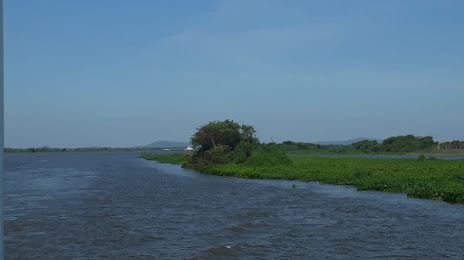
India Muerta
Chochis
Roboré
Tucavaca
El Carmen Rivero Torres
Puerto Suárez
San Matías — Sacaba
San Matías — Ancaravi
San Matías — Río Grande
San Matías — San Ignacio
San Matías — Pagador
San Matías — Sud Cinti
San Matías — Montero
San Matías — Escoma
San Matías — Saipina
San Matías — Barraca
San Matías — Puerto Quijarro
San Matías — Pongo
San Matías — Santivañez
San Matías — Tarata
San Matías — Coripata
San Matías — Atocha
San Matías — German Busch Province
San Matías — Totora
San Matías — Tiwanaku
India Muerta
Chochis
Roboré
Tucavaca
El Carmen Rivero Torres
Puerto Suárez
San Matías — Puerto Suárez distance, route on the map
Distance by car
Distance between San Matías, Santa Cruz Department, Bolivia and Puerto Suárez, Santa Cruz, Bolivia by car is — km, or miles. To travel this distance by car, you need minute, or h.
Route on the map, driving directions
Car route San Matías — Puerto Suárez was created automatically. The road on the map is shown as a blue line. By moving the markers, you can create a new route through the points you need.
Passing cities through which the car route passes: San José de Chiquitos, India Muerta, Chochis, Roboré, Tucavaca, El Carmen Rivero Torres, Puerto Suárez.
Distance by plane
If you decide to take a trip San Matías Puerto Suárez by plane, then you have to fly the distance — 295 km or 183 miles. It is marked on the map with a gray line (between two points in a straight line).
Flight time
Estimated flight time San Matías Puerto Suárez by plane at cruising speed 750 km / h will be — 23 min.
Direction of movement
Bolivia, San Matías — right-hand traffic. Bolivia, Puerto Suárez — right-hand traffic.
Difference in time
San Matías and Puerto Suárez are in the same time zone. Between them there is no time difference (UTC -4 America/La_Paz).
Interesting Facts
Information on alternative ways to get to your destination.
The length of this distance is about 0.7% of the total length of the equator.
The percentage of the population is clearly shown in the graph:
San Matías — 6,352 (less by 5,902), Puerto Suárez — 12,254 residents.
The cost of travel
Calculate the cost of the trip yourself using the fuel consumption calculator, changing the data in the table.