El Baluarte — San Sebastián Yutanino
El Baluarte — Pánuco
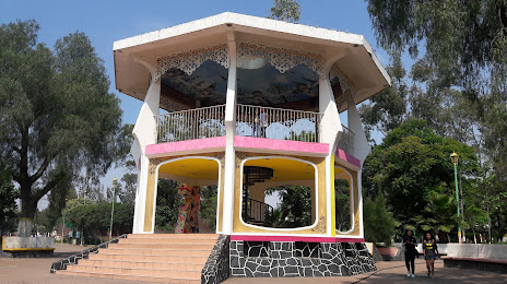
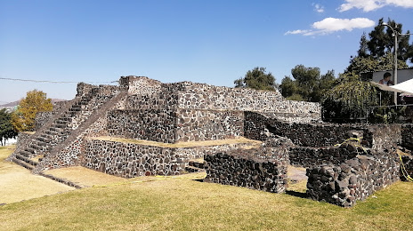
El Baluarte — Huépac
El Baluarte — The crosses
El Baluarte — Lerma
El Baluarte — Mérida
El Baluarte — Apodaca
El Baluarte — Opodepe
El Baluarte — Corregidora
El Baluarte — Mineral del Chico
El Baluarte — Peñón Blanco
El Baluarte — Macuspana
El Baluarte — Purépero de Echáiz
El Baluarte — Casas Grandes Municipality
El Baluarte — Tepango de Rodríguez
El Baluarte — The Norita
El Baluarte — Tlaltizapán
El Baluarte — Llano Chico
El Baluarte — Kantunilkín
Plateros
Fresnillo
Estación San José
Taray
Calera
De Guerreros
Guadalupe
Trancoso
San José el Saladillo
Salinas de Hidalgo
Coyotillos
Mexquitic de Carmona
San Luis Potosi
San Luis Potosi
San Luis Potosi
Los Gomez
Santa María del Río
Villela
Purisima
San Luis de la Paz
San José Iturbide
La Gotera
Santa Rosa Jáuregui
San Jose El Alto
Amazcala
Saldarriaga
Querétaro
San Cristobal
Pedro Escobedo
El Sauz
Loma Linda
San Juan del Río
Ejido San Sebastián de las Barrancas
El Cazadero
Calpulalpan
Tepeji de Ocampo
Huehuetoca
Coyotepec
Teoloyucan
Jaltenco
Nextlalpan
Tonanitla
Ojo de Agua
Ciudad Nezahualcóyotl
Tejedores
El Baluarte — San Sebastián Yutanino
El Baluarte — Pánuco
El Baluarte — Huépac
El Baluarte — The crosses
El Baluarte — Lerma
El Baluarte — Mérida
El Baluarte — Apodaca
El Baluarte — Opodepe
El Baluarte — Corregidora
El Baluarte — Mineral del Chico
El Baluarte — Peñón Blanco
El Baluarte — Macuspana
El Baluarte — Purépero de Echáiz
El Baluarte — Casas Grandes Municipality
El Baluarte — Tepango de Rodríguez
El Baluarte — The Norita
El Baluarte — Tlaltizapán
El Baluarte — Llano Chico
El Baluarte — Kantunilkín
Plateros
Fresnillo
Estación San José
Taray
Calera
De Guerreros
Guadalupe
Trancoso
San José el Saladillo
Salinas de Hidalgo
Coyotillos
Mexquitic de Carmona
San Luis Potosi
San Luis Potosi
San Luis Potosi
Los Gomez
Santa María del Río
Villela
Purisima
San Luis de la Paz
San José Iturbide
La Gotera
Santa Rosa Jáuregui
San Jose El Alto
Amazcala
Saldarriaga
Querétaro
San Cristobal
Pedro Escobedo
El Sauz
Loma Linda
San Juan del Río
Ejido San Sebastián de las Barrancas
El Cazadero
Calpulalpan
Tepeji de Ocampo
Huehuetoca
Coyotepec
Teoloyucan
Jaltenco
Nextlalpan
Tonanitla
Ojo de Agua
Ciudad Nezahualcóyotl
Tejedores
El Baluarte — Ciudad Nezahualcóyotl distance, route on the map
Distance by car
Distance between El Baluarte, Zacatecas, Mexico and Ciudad Nezahualcóyotl, State of Mexico, Mexico by car is — km, or miles. To travel this distance by car, you need minute, or h.
Route on the map, driving directions
Car route El Baluarte — Ciudad Nezahualcóyotl was created automatically. The road on the map is shown as a blue line. By moving the markers, you can create a new route through the points you need.
Passing cities through which the car route passes: San José de Lourdes, Plateros, Fresnillo, Estación San José, Taray, Calera, De Guerreros, Guadalupe, Trancoso, San José el Saladillo, Salinas de Hidalgo, Coyotillos, Mexquitic de Carmona, San Luis Potosi, San Luis Potosi, San Luis Potosi, Los Gomez, Santa María del Río, Villela, Purisima, San Luis de la Paz, San José Iturbide, La Gotera, Santa Rosa Jáuregui, San Jose El Alto, Amazcala, Saldarriaga, Querétaro, San Cristobal, Pedro Escobedo, El Sauz, Loma Linda, San Juan del Río, Ejido San Sebastián de las Barrancas, El Cazadero, Calpulalpan, Tepeji de Ocampo, Huehuetoca, Coyotepec, Teoloyucan, Jaltenco, Nextlalpan, Tonanitla, Ojo de Agua, Ciudad Nezahualcóyotl, Tejedores.
Distance by plane
If you decide to take a trip El Baluarte Ciudad Nezahualcóyotl by plane, then you have to fly the distance — 612 km or 379 miles. It is marked on the map with a gray line (between two points in a straight line).
Flight time
Estimated flight time El Baluarte Ciudad Nezahualcóyotl by plane at cruising speed 750 km / h will be — 48 min.
Direction of movement
Mexico, El Baluarte — right-hand traffic. Mexico, Ciudad Nezahualcóyotl — right-hand traffic.
Difference in time
El Baluarte and Ciudad Nezahualcóyotl are in the same time zone. Between them there is no time difference (UTC -6 America/Mexico_City).
Interesting Facts
Information on alternative ways to get to your destination.
The length of this distance is about 1.5% of the total length of the equator.
The cost of travel
Calculate the cost of the trip yourself using the fuel consumption calculator, changing the data in the table.