Ciudad de Villaldama — Tepechitlán
Ciudad de Villaldama — Lázaro Cárdenas
Ciudad de Villaldama — Padilla
Ciudad de Villaldama — Ocuituco
Ciudad de Villaldama — Cristóbal Obregón
Ciudad de Villaldama — Kohunlich
Ciudad de Villaldama — Perote
Ciudad de Villaldama — Zumpahuacán
Ciudad de Villaldama — Kimbilá
Ciudad de Villaldama — San Rafael
Ciudad de Villaldama — Tlalchapa
Ciudad de Villaldama — Naica
Ciudad de Villaldama — Tomatlán
Ciudad de Villaldama — Campo Morado
Ciudad de Villaldama — San Juan de las Gaviotas
Ciudad de Villaldama — Amatal
Ciudad de Villaldama — Jiménez
Ciudad de Villaldama — Tepatitlan de Morelos
Ciudad de Villaldama — Calderitas
Salinas Victoria
Apodaca
General Escobedo
La Concordia
Hacienda de San Juan de Buenavista
Aeropuerto Saltillo “Plan de Guadalupe”
Ramos Arizpe
Saltillo
Saltillo
Narigua
Paila
El Sol
Matamoros
La Esperanza
La Partida
Hormiguero
The flower
Gómez Palacio
Transport
Lerdo
León Guzmán
Chocolate
Pedriceña
Guadalupe Victoria
Guadalupe Victoria
Veintisiete de Noviembre
Durango
El Salto
Pueblo Nuevo
Zapote
La Petaca
Copala
Concordia
Villa Unión
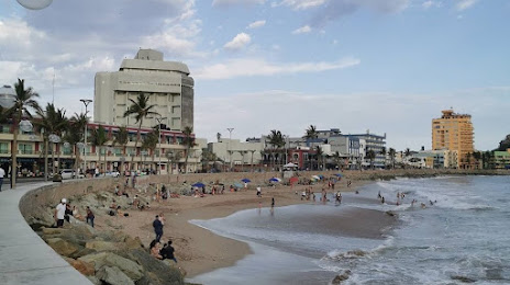
Mazatlán International Airport
Ciudad de Villaldama — Tepechitlán
Ciudad de Villaldama — Lázaro Cárdenas
Ciudad de Villaldama — Padilla
Ciudad de Villaldama — Ocuituco
Ciudad de Villaldama — Cristóbal Obregón
Ciudad de Villaldama — Kohunlich
Ciudad de Villaldama — Perote
Ciudad de Villaldama — Zumpahuacán
Ciudad de Villaldama — Kimbilá
Ciudad de Villaldama — San Rafael
Ciudad de Villaldama — Tlalchapa
Ciudad de Villaldama — Naica
Ciudad de Villaldama — Tomatlán
Ciudad de Villaldama — Campo Morado
Ciudad de Villaldama — San Juan de las Gaviotas
Ciudad de Villaldama — Amatal
Ciudad de Villaldama — Jiménez
Ciudad de Villaldama — Tepatitlan de Morelos
Ciudad de Villaldama — Calderitas
Salinas Victoria
Apodaca
General Escobedo
La Concordia
Hacienda de San Juan de Buenavista
Aeropuerto Saltillo “Plan de Guadalupe”
Ramos Arizpe
Saltillo
Saltillo
Narigua
Paila
El Sol
Matamoros
La Esperanza
La Partida
Hormiguero
The flower
Gómez Palacio
Transport
Lerdo
León Guzmán
Chocolate
Pedriceña
Guadalupe Victoria
Guadalupe Victoria
Veintisiete de Noviembre
Durango
El Salto
Pueblo Nuevo
Zapote
La Petaca
Copala
Concordia
Villa Unión
Mazatlán International Airport
Ciudad de Villaldama — Mazatlán distance, route on the map
Distance by car
Distance between Ciudad de Villaldama, Nuevo León, Mexico and Mazatlán, Sinaloa, Mexico by car is — km, or miles. To travel this distance by car, you need minute, or h.
Route on the map, driving directions
Car route Ciudad de Villaldama — Mazatlán was created automatically. The road on the map is shown as a blue line. By moving the markers, you can create a new route through the points you need.
Passing cities through which the car route passes: Salinas Victoria, Salinas Victoria, Apodaca, General Escobedo, La Concordia, Hacienda de San Juan de Buenavista, Aeropuerto Saltillo “Plan de Guadalupe”, Ramos Arizpe, Saltillo, Saltillo, Narigua, Paila, El Sol, Matamoros, La Esperanza, La Partida, Hormiguero, The flower, Gómez Palacio, Transport, Lerdo, León Guzmán, Chocolate, Pedriceña, Guadalupe Victoria, Guadalupe Victoria, Veintisiete de Noviembre, Durango, El Salto, Pueblo Nuevo, Zapote, La Petaca, Copala, Concordia, Villa Unión, Mazatlán International Airport.
Distance by plane
If you decide to take a trip Ciudad de Villaldama Mazatlán by plane, then you have to fly the distance — 703 km or 436 miles. It is marked on the map with a gray line (between two points in a straight line).
Flight time
Estimated flight time Ciudad de Villaldama Mazatlán by plane at cruising speed 750 km / h will be — 56 min.
Direction of movement
Mexico, Ciudad de Villaldama — right-hand traffic. Mexico, Mazatlán — right-hand traffic.
Difference in time
Ciudad de Villaldama and Mazatlán are in different time zones. The time difference is 1 hour (UTC -6 America/Mexico_City, UTC -7 America/Mazatlan).
Interesting Facts
Information on alternative ways to get to your destination.
The length of this distance is about 1.8% of the total length of the equator.
The cost of travel
Calculate the cost of the trip yourself using the fuel consumption calculator, changing the data in the table.