
 Swidwin
Susz
Iłża
Chojnów
Radymno
Kamień Pomorski
Jedlińsk
Głogówek
Hyżne
Zukowo
Kamień Krajeński
Wydminy
Jastarnia
Strzelce Wielkie
Pełczyce
Ciechocinek
Gierałtowice
Kozłowo
Sośnicowice
Swidwin
Susz
Iłża
Chojnów
Radymno
Kamień Pomorski
Jedlińsk
Głogówek
Hyżne
Zukowo
Kamień Krajeński
Wydminy
Jastarnia
Strzelce Wielkie
Pełczyce
Ciechocinek
Gierałtowice
Kozłowo
Sośnicowice
Szprotawa on the map, Poland
Where is located Szprotawa
Exact location — Szprotawa, Żagań County, Lubusz Voivodeship, Poland, marked on the map with a red marker.
Coordinates
Szprotawa, Poland coordinates in decimal format: latitude — 51.56696, longitude — 15.53798. When converted to degrees, minutes, seconds Szprotawa has the following coordinates: 51°34′1.06 north latitude and 15°32′16.73 east longitude.
Population
Szprotawa, Żagań County, Lubusz Voivodeship, Poland, according to our data the population is — 12,786 residents, which is about 0% of the total population of the country (Poland).
Comparison of the population on the graph:
Exact time
Time zone for this location Szprotawa — UTC +2 Europe/Warsaw. Exact time — thursday, 5 may 2024 year, 02 h. 22 minutes.
Sunrise and sunset
Szprotawa, sunrise and sunset data for a date — thursday 9.05.2024.
| Sunrise | Sunset | Day (duration) |
|---|---|---|
| 05:18 -2 minutes | 20:30 +2 minutes | 15 h. 12 minutes. +4 minutes |
You can control the scale of the map using the auxiliary tools to find out exactly where it is located Szprotawa. When you change the scale of the map, the width of the ruler also changes (in kilometers and miles).
Nearby cities
The largest cities that are located nearby:
- Zielona Gora — 41 km
- Legnica — 58 km
- Cottbus
 (Germany) — 85 km
 - Walbrzych — 101 km
- Wrocław — 116 km
- Gorzów Wielkopolski — 130 km
- Poznań — 132 km
- Dresden (Germany) — 138 km
- Kalisz — 176 km
- Berlin (Germany) — 177 km
- Berlin (Germany) — 178 km
- Prague
 (Czech Republic) — 182 km
 - Potsdam (Germany) — 190 km
- Opole — 194 km
- Chemnitz (Germany) — 200 km
- Szczecin — 216 km
- Leipzig (Germany) — 220 km
- Bydgoszcz — 238 km
- Olomouc (Czech Republic) — 250 km
Distance to neighboring capitals:
- Berlin (Germany) — 180 km
- Prague (Czech Republic) — 183 km
- Vienna
 (Austria) — 378 km
 - Bratislava
 (Slovakia) — 397 km
 - Copenhagen
 (Denmark) — 497 km
 - Budapest
 (Hungary) — 518 km
 - Amsterdam
 (Netherlands) — 734 km
 - Vilnius
 (Lithuania) — 736 km
 - Bern
 (Switzerland) — 780 km
 - Rīga
 (Latvia) — 816 km
 - Belgrade
 (Serbia) — 837 km
 - Minsk
 (Belarus) — 849 km
 - Paris
 (France) — 984 km
 - Kyiv
 (Ukraine) — 1054 km
 - Bucharest
 (Romania) — 1115 km
 - Helsinki
 (Finland) — 1120 km
 - Moscow
 (Russia) — 1520 km
 - Tbilisi
 (Georgia) — 2465 km
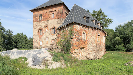
Attractions

Distance to the capital
Distance to the capital (Warsaw) is about — 383 km.