Poselok Mirnyy (Kazan') — Tetevo
Poselok Mirnyy (Kazan') — Yoshkar-Ola
Poselok Mirnyy (Kazan') — Oktyabrsky
Poselok Mirnyy (Kazan') — Kurumoch International Airport
Poselok Mirnyy (Kazan') — Listvyanka
Poselok Mirnyy (Kazan') — Momotovo
Poselok Mirnyy (Kazan') — Inozemtsevo
Poselok Mirnyy (Kazan') — Korolenko
Poselok Mirnyy (Kazan') — Devino
Poselok Mirnyy (Kazan') — Nyva
Poselok Mirnyy (Kazan') — Bolsheokinskoye
Poselok Mirnyy (Kazan') — Pytalovsky District
Poselok Mirnyy (Kazan') — Seryy Kamen'
Poselok Mirnyy (Kazan') — Ola
Poselok Mirnyy (Kazan') — Ponyri
Poselok Mirnyy (Kazan') — Svobodnoye
Poselok Mirnyy (Kazan') — Svetly Yar
Poselok Mirnyy (Kazan') — Doma 45 miles
Poselok Mirnyy (Kazan') — Yarkovo
Kazan
Kazan
Osinovo
Novaya Tura
Orekhovka
Oktyabr'skiy
Naberezhnye Morkvashi
Pustyye Morkvashi
Savino
Tatarskoye Burnashevo
Gavrilkovo
Bol'shoye Khodyashevo
Kireyevo
Malyye Achasyry
Tyurlema
Tyurlema
Kozlovskiy Rayon
Kugeyevo
Opytnyy
Tsivilsk
Cheboksarskiy Rayon
Kugesi
Dubrava
Vurmankasy
Shomikovo
Moskakasy
Nikolskoye
Vorotynets
Lyskovo
Bogomolovo
Veliky Vrag
Zeletsino
Sheloksha
Kremenki
Strigino Airport
Gavrilovka
Gorbatovka
Lazur'
Dzerzhinsk
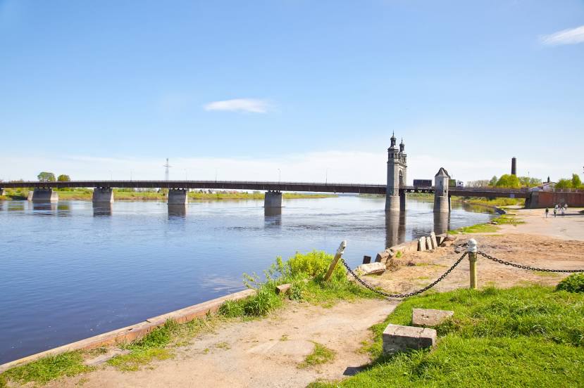
Poselok Mirnyy (Kazan') — Sovetsk distance, route on the map
Distance by car
Distance between Poselok Mirnyy (Kazan'), Respublika Tatarstan, Russian Federation and Sovetsk, Kaliningrad Oblast, Russian Federation by car is — km, or miles. To travel this distance by car, you need minute, or h.
Route on the map, driving directions
Car route Poselok Mirnyy (Kazan') — Sovetsk was created automatically. The road on the map is shown as a blue line. By moving the markers, you can create a new route through the points you need.
Passing cities through which the car route passes: Kazan, Kazan, Kazan, Osinovo, Novaya Tura, Orekhovka, Oktyabr'skiy, Naberezhnye Morkvashi, Pustyye Morkvashi, Savino, Tatarskoye Burnashevo, Gavrilkovo, Bol'shoye Khodyashevo, Kireyevo, Malyye Achasyry, Tyurlema, Tyurlema, Kozlovskiy Rayon, Kugeyevo, Opytnyy, Tsivilsk, Cheboksarskiy Rayon, Kugesi, Dubrava, Vurmankasy, Shomikovo, Moskakasy, Nikolskoye, Vorotynets, Lyskovo, Bogomolovo, Veliky Vrag, Zeletsino, Sheloksha, Kremenki, Strigino Airport, Gavrilovka, Gorbatovka, Lazur', Dzerzhinsk.
Distance by plane
If you decide to take a trip Poselok Mirnyy (Kazan') Sovetsk by plane, then you have to fly the distance — 1714 km or 1063 miles. It is marked on the map with a gray line (between two points in a straight line).
Flight time
Estimated flight time Poselok Mirnyy (Kazan') Sovetsk by plane at cruising speed 750 km / h will be — 2 h. and 17 min.
Direction of movement
Russian Federation, Poselok Mirnyy (Kazan') — right-hand traffic. Russian Federation, Sovetsk — right-hand traffic.
Difference in time
Poselok Mirnyy (Kazan') and Sovetsk are in different time zones. The time difference is 1 hour (UTC +3 Europe/Moscow, UTC +2 Europe/Kaliningrad).
Interesting Facts
Information on alternative ways to get to your destination.
The length of this distance is about 4.3% of the total length of the equator.
The cost of travel
Calculate the cost of the trip yourself using the fuel consumption calculator, changing the data in the table.