Três Lagoas — Tiradentes
Três Lagoas — Canga
Três Lagoas — Colombo
Três Lagoas — Caioba Portal
Três Lagoas — Oriximiná
Três Lagoas — Jaguarão
Três Lagoas — Sem-Peixe
Três Lagoas — Benevides
Três Lagoas — Galiléia
Três Lagoas — Porto de Galinhas
Três Lagoas — Sítio das Chagas
Três Lagoas — Portalegre
Três Lagoas — Ribeirão das Neves
Três Lagoas — Paracatu
Três Lagoas — Orizona
Três Lagoas — Rio Negro
Três Lagoas — São Thomé das Letras
Três Lagoas — Km 19
Três Lagoas — Dobrada
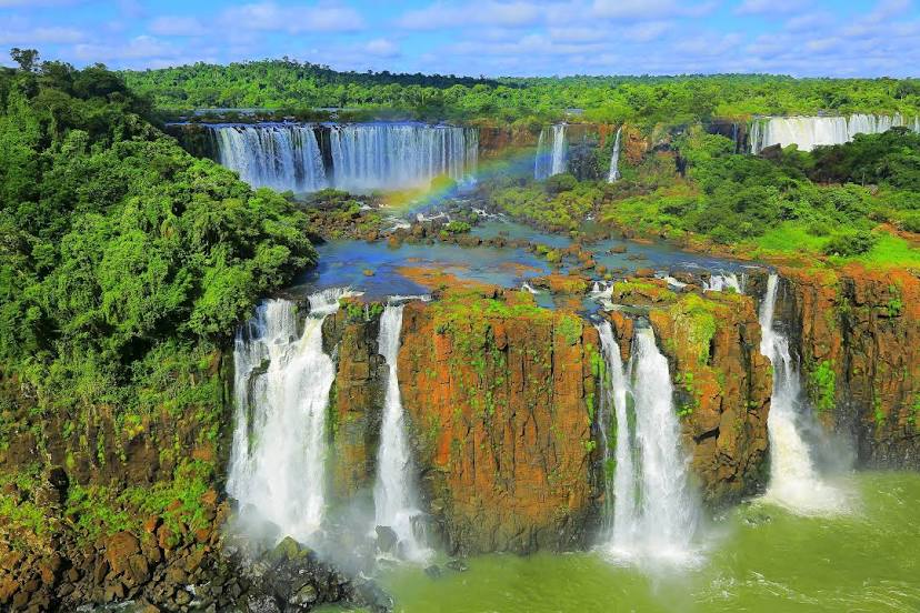
Três Lagoas — Foz do Iguaçu distance, route on the map
Distance by car
Distance between Três Lagoas, Mato Grosso do Sul, Brazil and Foz do Iguaçu, Paraná, Brazil by car is — km, or miles. To travel this distance by car, you need minute, or h.
Route on the map, driving directions
Car route Três Lagoas — Foz do Iguaçu was created automatically. The road on the map is shown as a blue line. By moving the markers, you can create a new route through the points you need.
Distance by plane
If you decide to take a trip Três Lagoas Foz do Iguaçu by plane, then you have to fly the distance — 603 km or 374 miles. It is marked on the map with a gray line (between two points in a straight line).
Flight time
Estimated flight time Três Lagoas Foz do Iguaçu by plane at cruising speed 750 km / h will be — 48 min.
Direction of movement
Brazil, Três Lagoas — right-hand traffic. Brazil, Foz do Iguaçu — right-hand traffic.
Difference in time
Três Lagoas and Foz do Iguaçu are in the same time zone. Between them there is no time difference (UTC -4 America/Campo_Grande).
Interesting Facts
Information on alternative ways to get to your destination.
The length of this distance is about 1.5% of the total length of the equator.
The percentage of the population is clearly shown in the graph:
Três Lagoas — 78,714 (less by 214,809), Foz do Iguaçu — 293,523 residents.
The cost of travel
Calculate the cost of the trip yourself using the fuel consumption calculator, changing the data in the table.