Adolfo Ruiz Cortines — Churintzio
Adolfo Ruiz Cortines — Casas Viejas
Adolfo Ruiz Cortines — Navolato
Adolfo Ruiz Cortines — Tezontepec de Aldama
Adolfo Ruiz Cortines — Ciénega de Nuestra Señora de Guadalupe
Adolfo Ruiz Cortines — Jalapa
Adolfo Ruiz Cortines — San Cristóbal
Adolfo Ruiz Cortines — Saltabarranca
Adolfo Ruiz Cortines — Merida
Adolfo Ruiz Cortines — La Cruz
Adolfo Ruiz Cortines — Carácuaro
Adolfo Ruiz Cortines — Cocoyoc, Morelos
Adolfo Ruiz Cortines — Acajete
Adolfo Ruiz Cortines — Barra de Navidad
Adolfo Ruiz Cortines — Banderas
Adolfo Ruiz Cortines — Hunucmá
Adolfo Ruiz Cortines — Cabrales
Adolfo Ruiz Cortines — 5
Adolfo Ruiz Cortines — Tres Marías
Cinco de Mayo
Guasave
Angostura
Colonia Independencia
Costa Rica
Isabelita
Loma
Ceuta
San Ignacio
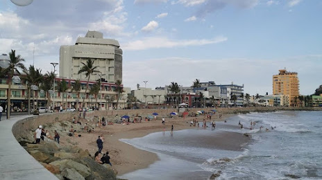
Adolfo Ruiz Cortines — Mazatlán distance, route on the map
Distance by car
Distance between Adolfo Ruiz Cortines, Sinaloa, Mexico and Mazatlán, Sinaloa, Mexico by car is — km, or miles. To travel this distance by car, you need minute, or h.
Route on the map, driving directions
Car route Adolfo Ruiz Cortines — Mazatlán was created automatically. The road on the map is shown as a blue line. By moving the markers, you can create a new route through the points you need.
Passing cities through which the car route passes: Batamote, Cinco de Mayo, Guasave, Angostura, Colonia Independencia, Costa Rica, Isabelita, Loma, Ceuta, San Ignacio.
Distance by plane
If you decide to take a trip Adolfo Ruiz Cortines Mazatlán by plane, then you have to fly the distance — 359 km or 223 miles. It is marked on the map with a gray line (between two points in a straight line).
Flight time
Estimated flight time Adolfo Ruiz Cortines Mazatlán by plane at cruising speed 750 km / h will be — 28 min.
Direction of movement
Mexico, Adolfo Ruiz Cortines — right-hand traffic. Mexico, Mazatlán — right-hand traffic.
Difference in time
Adolfo Ruiz Cortines and Mazatlán are in the same time zone. Between them there is no time difference (UTC -7 America/Mazatlan).
Interesting Facts
Information on alternative ways to get to your destination.
The length of this distance is about 0.9% of the total length of the equator.
The percentage of the population is clearly shown in the graph:
Adolfo Ruiz Cortines — 12,947 (less by 341,783), Mazatlán — 354,730 residents.
The cost of travel
Calculate the cost of the trip yourself using the fuel consumption calculator, changing the data in the table.