San Jose El Alto — Oaxaca
San Jose El Alto — Aquila
San Jose El Alto — Yobaín
San Jose El Alto — Saint Ana
San Jose El Alto — Lerdo
San Jose El Alto — Tetla
San Jose El Alto — Teotihuacán de Arista
San Jose El Alto — Villachuato
San Jose El Alto — Janos
San Jose El Alto — El Palmito
San Jose El Alto — Ignacio Zaragoza
San Jose El Alto — Córdoba
San Jose El Alto — Uriangato
San Jose El Alto — Villa Victoria
San Jose El Alto — Hualahuises
San Jose El Alto — Puebla
San Jose El Alto — Actopan
San Jose El Alto — Acatic
San Jose El Alto — El Vigía
La Gotera
San José Iturbide
San Luis de la Paz
Purisima
Villela
Santa María del Río
Cerro de San Pedro
Villa de Hidalgo
Peotillos
Charco Blanco
Montaña
Cerritos
Tula
Tula
Encarnación
Palmillas
Jaumave
Ciudad Victoria
Mexico
La Ciénega
Güémez
Nueva Villa de Padilla
Padilla
Santander Jiménez
San Fernando
Águila Azteca
General Servando Canales International Airport
San Jose El Alto — Oaxaca
San Jose El Alto — Aquila
San Jose El Alto — Yobaín
San Jose El Alto — Saint Ana
San Jose El Alto — Lerdo
San Jose El Alto — Tetla
San Jose El Alto — Teotihuacán de Arista
San Jose El Alto — Villachuato
San Jose El Alto — Janos
San Jose El Alto — El Palmito
San Jose El Alto — Ignacio Zaragoza
San Jose El Alto — Córdoba
San Jose El Alto — Uriangato
San Jose El Alto — Villa Victoria
San Jose El Alto — Hualahuises
San Jose El Alto — Puebla
San Jose El Alto — Actopan
San Jose El Alto — Acatic
San Jose El Alto — El Vigía
La Gotera
San José Iturbide
San Luis de la Paz
Purisima
Villela
Santa María del Río
Cerro de San Pedro
Villa de Hidalgo
Peotillos
Charco Blanco
Montaña
Cerritos
Tula
Tula
Encarnación
Palmillas
Jaumave
Ciudad Victoria
Mexico
La Ciénega
Güémez
Nueva Villa de Padilla
Padilla
Santander Jiménez
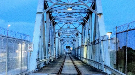
San Fernando
Águila Azteca
General Servando Canales International Airport
San Jose El Alto — Matamoros distance, route on the map
Distance by car
Distance between San Jose El Alto, Querétaro, Mexico and Matamoros, Tamaulipas, Mexico by car is — km, or miles. To travel this distance by car, you need minute, or h.
Route on the map, driving directions
Car route San Jose El Alto — Matamoros was created automatically. The road on the map is shown as a blue line. By moving the markers, you can create a new route through the points you need.
Passing cities through which the car route passes: Santa Rosa Jáuregui, La Gotera, San José Iturbide, San Luis de la Paz, Purisima, Villela, Santa María del Río, Cerro de San Pedro, Villa de Hidalgo, Peotillos, Charco Blanco, Montaña, Cerritos, Tula, Tula, Encarnación, Palmillas, Jaumave, Ciudad Victoria, Mexico, La Ciénega, Güémez, Nueva Villa de Padilla, Padilla, Santander Jiménez, San Fernando, Águila Azteca, General Servando Canales International Airport.
Distance by plane
If you decide to take a trip San Jose El Alto Matamoros by plane, then you have to fly the distance — 651 km or 404 miles. It is marked on the map with a gray line (between two points in a straight line).
Flight time
Estimated flight time San Jose El Alto Matamoros by plane at cruising speed 750 km / h will be — 52 min.
Direction of movement
Mexico, San Jose El Alto — right-hand traffic. Mexico, Matamoros — right-hand traffic.
Difference in time
San Jose El Alto and Matamoros are in the same time zone. Between them there is no time difference (UTC -6 America/Mexico_City).
Interesting Facts
Information on alternative ways to get to your destination.
The length of this distance is about 1.6% of the total length of the equator.
The percentage of the population is clearly shown in the graph:
San Jose El Alto — 5,957 (less by 429,202), Matamoros — 435,159 residents.
The cost of travel
Calculate the cost of the trip yourself using the fuel consumption calculator, changing the data in the table.