
 Pakosławice
Domaszowice
Cmolas
Dmosin
Wiśniew
Koniusza
Nowy Żmigród
Łabiszyn
Skarszewy
Łabunie
Walce
Czudec
Głuchołazy
Staszow
Polska Cerekiew
Jemielnica
Miejska Górka
Prudnik
Olsztynek
Pakosławice
Domaszowice
Cmolas
Dmosin
Wiśniew
Koniusza
Nowy Żmigród
Łabiszyn
Skarszewy
Łabunie
Walce
Czudec
Głuchołazy
Staszow
Polska Cerekiew
Jemielnica
Miejska Górka
Prudnik
Olsztynek
Kolbuszowa on the map, Poland
Where is located Kolbuszowa
Exact location — Kolbuszowa, Kolbuszowa County, Podkarpackie Voivodeship, Poland, marked on the map with a red marker.
Coordinates
Kolbuszowa, Poland coordinates in decimal format: latitude — 50.24417, longitude — 21.77627. When converted to degrees, minutes, seconds Kolbuszowa has the following coordinates: 50°14′39.01 north latitude and 21°46′34.57 east longitude.
Population
Kolbuszowa, Kolbuszowa County, Podkarpackie Voivodeship, Poland, according to our data the population is — 10,442 residents, which is about 0% of the total population of the country (Poland).
Comparison of the population on the graph:
Exact time
Time zone for this location Kolbuszowa — UTC +2 Europe/Warsaw. Exact time — friday, 5 may 2024 year, 14 h. 50 minutes.
Sunrise and sunset
Kolbuszowa, sunrise and sunset data for a date — friday 3.05.2024.
| Sunrise | Sunset | Day (duration) |
|---|---|---|
| 05:07 -2 minutes | 19:51 +1 minute | 14 h. 42 minutes. +3 minutes |
You can control the scale of the map using the auxiliary tools to find out exactly where it is located Kolbuszowa. When you change the scale of the map, the width of the ruler also changes (in kilometers and miles).
Nearby cities
The largest cities that are located nearby:
- Rzeszow — 27 km
- Tarnow — 62 km
- Kielce — 106 km
- Lublin — 124 km
- Kraków — 131 km
- Radom — 135 km
- Košice
 (Slovakia) — 173 km
 - Dabrowa Gornicza — 182 km
- Uzhhorod
 (Ukraine) — 183 km
 - Sosnowiec — 189 km
- Katowice — 195 km
- Częstochowa — 196 km
- Chorzow — 199 km
- Bielsko-Biala — 199 km
- Bytom — 202 km
- Ruda Slaska — 206 km
- Zabrze — 211 km
- Gliwice — 219 km
- Rybnik — 230 km
Distance to neighboring capitals:
- Budapest
 (Hungary) — 365 km
 - Bratislava (Slovakia) — 412 km
- Vienna
 (Austria) — 453 km
 - Prague
 (Czech Republic) — 523 km
 - Vilnius
 (Lithuania) — 548 km
 - Minsk
 (Belarus) — 567 km
 - Belgrade
 (Serbia) — 615 km
 - Kyiv (Ukraine) — 621 km
- Berlin
 (Germany) — 633 km
 - Bucharest
 (Romania) — 724 km
 - Rīga
 (Latvia) — 761 km
 - Copenhagen
 (Denmark) — 862 km
 - Bern
 (Switzerland) — 1114 km
 - Helsinki
 (Finland) — 1122 km
 - Amsterdam
 (Netherlands) — 1194 km
 - Moscow
 (Russia) — 1221 km
 - Paris
 (France) — 1406 km
 - Tbilisi
 (Georgia) — 2004 km
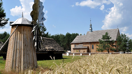
Attractions
Distance to the capital
Distance to the capital (Warsaw) is about — 227 km.