
 Mikhaylovka
Dyrestuy
Mikhaylovka
Mayskiy
Novobessergenevka
Tersky District
Lesnoy
Tertezh
Kuz'minskiye Otverzhki
Mikhaylovka
Dyrestuy
Mikhaylovka
Mayskiy
Novobessergenevka
Tersky District
Lesnoy
Tertezh
Kuz'minskiye Otverzhki
Fortaleza de Ivángorod on the map, Ivangorod, Russian Federation
Photo
Where is located Fortaleza de Ivángorod
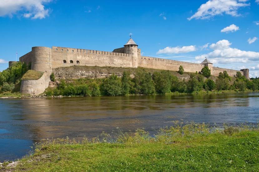
Fortaleza de Ivángorod — local attraction, which is located at Kingiseppskoye Shosse, 6, Ivangorod, Leningrad Oblast, 188490 and belongs to the category — medieval castle. Average visitor rating for this place — 4.8 (according to 1088 ratings, information from open sources and relevant for 2022).
Exact location — Fortaleza de Ivángorod, marked on the map with a red marker.
You can get directions to Fortaleza de Ivángorod on the map from your location.
What else is interesting in Ivangorod? You can see all the sights if you go to the city page.
Coordinates
Fortaleza de Ivángorod, Russian Federation coordinates in decimal format: latitude — 59.374719221072475, longitude — 28.208164898599136. When converted to degrees, minutes, seconds Fortaleza de Ivángorod has the following coordinates: 59°22′28.99 north latitude and 28°12′29.39 east longitude.
Nearby cities
The largest cities that are located nearby:
- Saint Petersburg — 133 km
- Kolpino — 139 km
- Tartu
 (Estonia) — 139 km
 - Pskov — 172 km
- Tallinn (Estonia) — 195 km
- Helsinki
 (Finland) — 201 km
 - Vantaa (Finland) — 202 km
- Espoo (Finland) — 217 km
- Tampere (Finland) — 333 km
- Turku (Finland) — 346 km
- Velikiye Luki — 364 km
- Rīga
 (Latvia) — 365 km
 - Daugavpils (Latvia) — 400 km
- Petrozavodsk — 417 km
- Navapolatsk
 (Belarus) — 426 km
 - Panevėžys
 (Lithuania) — 468 km
 - Šiauliai (Lithuania) — 486 km
- Tver — 542 km
- Vilnius (Lithuania) — 550 km
Distance to the capital
Distance to the capital (Moscow) is about — 690 km.