
 Mednogorsk
Kolpashevo
Kolyubakino
Bodaybo
Neryungri
Doronina
Nemchinovo
Remizov
Morozovsk
Drakino
Udomlya
Volosovo
Staryi Krym
Mednogorsk
Kolpashevo
Kolyubakino
Bodaybo
Neryungri
Doronina
Nemchinovo
Remizov
Morozovsk
Drakino
Udomlya
Volosovo
Staryi Krym  Mozhga
Novotitarovskaya
Kanevskaya
Armavir
Polevoy
Olovyannaya
Mozhga
Novotitarovskaya
Kanevskaya
Armavir
Polevoy
Olovyannaya
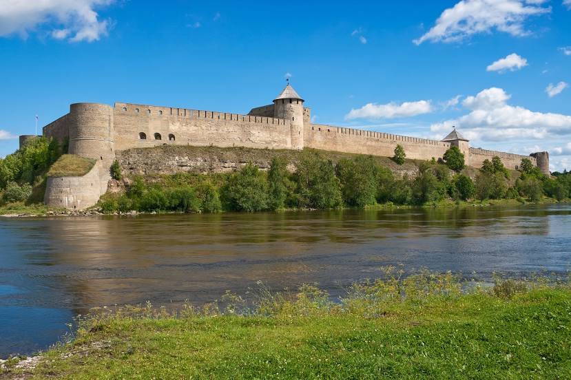
Ivangorod on the map, Russian Federation
Where is located Ivangorod
Exact location — Ivangorod, Kingiseppsky District, Leningrad Oblast, Russia, marked on the map with a red marker.
Coordinates
Ivangorod, Russian Federation coordinates in decimal format: latitude — 59.366667, longitude — 28.216667. When converted to degrees, minutes, seconds Ivangorod has the following coordinates: 59°22′0 north latitude and 28°13′0 east longitude.
Population
Ivangorod, Kingiseppsky District, Leningrad Oblast, Russia, according to our data the population is — 11,074 residents, which is about 0% of the total population of the country (Russian Federation).
Comparison of the population on the graph:
Exact time
Time zone for this location Ivangorod — UTC +3 Europe/Moscow. Exact time — saturday, 5 may 2024 year, 00 h. 49 minutes.
Sunrise and sunset
Ivangorod, sunrise and sunset data for a date — saturday 11.05.2024.
| Sunrise | Sunset | Day (duration) |
|---|---|---|
| 04:47 -2 minutes | 21:19 +2 minutes | 16 h. 30 minutes. +4 minutes |
You can control the scale of the map using the auxiliary tools to find out exactly where it is located Ivangorod. When you change the scale of the map, the width of the ruler also changes (in kilometers and miles).
Nearby cities
The largest cities that are located nearby:
- Saint Petersburg — 133 km
- Kolpino — 139 km
- Tartu
 (Estonia) — 139 km
 - Pskov — 172 km
- Tallinn (Estonia) — 195 km
- Helsinki
 (Finland) — 201 km
 - Vantaa (Finland) — 202 km
- Espoo (Finland) — 217 km
- Tampere (Finland) — 333 km
- Turku (Finland) — 346 km
- Velikiye Luki — 364 km
- Rīga
 (Latvia) — 365 km
 - Daugavpils (Latvia) — 400 km
- Petrozavodsk — 417 km
- Navapolatsk
 (Belarus) — 426 km
 - Panevėžys
 (Lithuania) — 468 km
 - Šiauliai (Lithuania) — 486 km
- Tver — 542 km
- Vilnius (Lithuania) — 550 km
Distance to neighboring capitals:
- Tallinn (Estonia) — 196 km
- Helsinki (Finland) — 204 km
- Rīga (Latvia) — 361 km
- Mariehamn (Åland Islands) — 471 km
- Vilnius (Lithuania) — 550 km
- Stockholm
 (Sweden) — 581 km
 - Minsk (Belarus) — 609 km
- Warsaw
 (Poland) — 912 km
 - Oslo
 (Norway) — 981 km
 - Kyiv
 (Ukraine) — 1003 km
 - Prague
 (Czech Republic) — 1355 km
 - Bucharest
 (Romania) — 1668 km
 - Tbilisi
 (Georgia) — 2272 km
 - Yerevan
 (Armenia) — 2419 km
 - Astana
 (Kazakhstan) — 2831 km
 - Tehran
 (Iran) — 3122 km
 - Khan-Uul
 (Mongolian) — 5019 km
 - Kathmandu
 (Nepal) — 5544 km
 - Beijing
 (China) — 6189 km
 - Pyongyang
 (North Korea) — 6747 km
 - Seoul
 (South Korea) — 6942 km
 - Hanoi
 (Vietnam) — 7313 km
Attractions
Distance to the capital
Distance to the capital (Moscow) is about — 689 km.