
 زفتى
Qesm Hurghada
Gazirat Muhammad
Qesm Nakhl
Om Sabir Village
6th of October City
Cairo Governorate
Qism Sidi Gabir
Ezbet Hussein Salamah
زفتى
Qesm Hurghada
Gazirat Muhammad
Qesm Nakhl
Om Sabir Village
6th of October City
Cairo Governorate
Qism Sidi Gabir
Ezbet Hussein Salamah
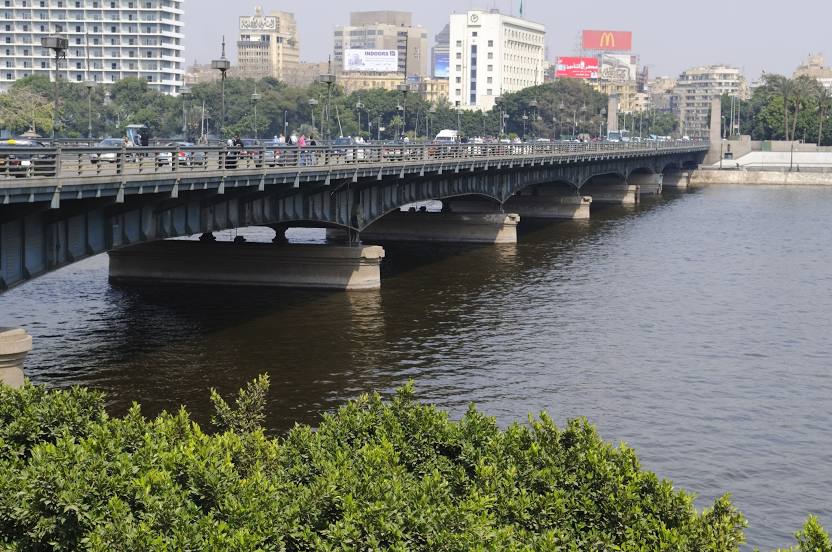
Kasr Al Nile Bridge كوبري قصر النيل on the map, Cairo, Egypt
Photo
Where is located Kasr Al Nile Bridge كوبري قصر النيل
Kasr Al Nile Bridge كوبري قصر النيل — local attraction, which is located at Kasr Al Nile Bridge, Qasr El Nil, Cairo Governorate, Egypt and belongs to the category — arch bridge. Average visitor rating for this place — 4.8 (according to 55 ratings, information from open sources and relevant for 2022).
Exact location — Kasr Al Nile Bridge كوبري قصر النيل, marked on the map with a red marker.
You can get directions to Kasr Al Nile Bridge كوبري قصر النيل on the map from your location.
What else is interesting in Cairo? You can see all the sights if you go to the city page.
Coordinates
Kasr Al Nile Bridge كوبري قصر النيل, Egypt coordinates in decimal format: latitude — 30.04397373424983, longitude — 31.229636097639975. When converted to degrees, minutes, seconds Kasr Al Nile Bridge كوبري قصر النيل has the following coordinates: 30°2′38.31 north latitude and 31°13′46.69 east longitude.
Nearby cities
The largest cities that are located nearby:
- Qalyub — 15 km
- Banha — 47 km
- Zagazig — 64 km
- Beni Suef — 109 km
- Talkha — 113 km
- Ismailia — 116 km
- Suez — 126 km
- Idku — 165 km
- Port Said — 168 km
- Alexandria — 178 km
- Mallawi — 258 km
- Asyut — 317 km
- Ashqelon
 (Israel) — 362 km
 - Ashdod (Israel) — 376 km
- Sohag — 388 km
- Bat Yam (Israel) — 395 km
- Tel Aviv-Yafo (Israel) — 402 km
- Ramat Gan (Israel) — 404 km
- Jerusalem (Israel) — 420 km