 Pointe-à-la-Croix
Sainte-Irène, Quebec
Marsoui
Hecla
Muskrat Dam
Wunnummin Lake
Sainte-Brigitte-de-Laval
Drayton
Mauricie
Pointe-à-la-Croix
Sainte-Irène, Quebec
Marsoui
Hecla
Muskrat Dam
Wunnummin Lake
Sainte-Brigitte-de-Laval
Drayton
Mauricie
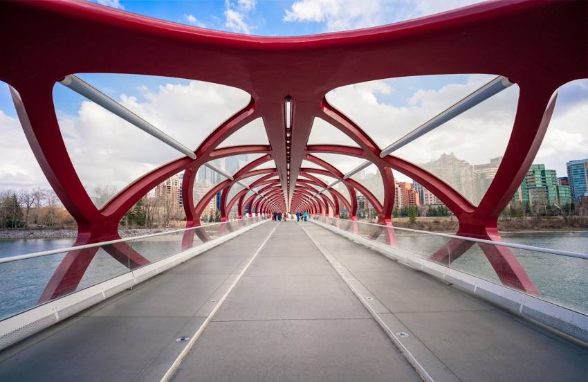
Peace Bridge on the map, Calgary, Canada
Photo
Where is located Peace Bridge
Peace Bridge — local attraction, which is located at Peace Bridge, Calgary, AB, Canada and belongs to the category — pedestrian bridge. Average visitor rating for this place — 4.6 (according to 2877 ratings, information from open sources and relevant for 2022).
Exact location — Peace Bridge, marked on the map with a red marker.
You can get directions to Peace Bridge on the map from your location.
What else is interesting in Calgary? You can see all the sights if you go to the city page.
Coordinates
Peace Bridge, Canada coordinates in decimal format: latitude — 51.054100963815905, longitude — -114.07895150172172. When converted to degrees, minutes, seconds Peace Bridge has the following coordinates: 51°3′14.76 north latitude and -114°4′44.23 east longitude.
Nearby cities
The largest cities that are located nearby:
- Edmonton — 279 km
- Kelowna — 407 km
- Spokane
 (United States) — 450 km
 - Saskatoon — 516 km
- Abbotsford — 638 km
- Coquitlam — 659 km
- Anmore — 662 km
- Surrey — 667 km
- Regina — 669 km
- Burnaby — 671 km
- Vancouver — 681 km
- Delta — 683 km
- Richmond — 687 km
- Bellevue (United States) — 715 km
- Seattle (United States) — 724 km
- Victoria — 741 km
- Tacoma (United States) — 756 km
- Boise (United States) — 839 km
- Portland (United States) — 904 km
Distance to the capital
Distance to the capital (Ottawa) is about — 2877 km.