 Pointe-à-la-Croix
Sainte-Irène, Quebec
Marsoui
Hecla
Muskrat Dam
Wunnummin Lake
Sainte-Brigitte-de-Laval
Drayton
Mauricie
Pointe-à-la-Croix
Sainte-Irène, Quebec
Marsoui
Hecla
Muskrat Dam
Wunnummin Lake
Sainte-Brigitte-de-Laval
Drayton
Mauricie
Memorial Park on the map, Oshawa, Canada
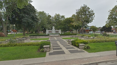
Photo
Where is located Memorial Park
Memorial Park — local attraction, which is located at 110 Simcoe St S, Oshawa, ON L1H 7M7, Canada and belongs to the category — park. Average visitor rating for this place — 4.0 (according to 548 ratings, information from open sources and relevant for 2022).
Exact location — Memorial Park, marked on the map with a red marker.
You can get directions to Memorial Park on the map from your location.
What else is interesting in Oshawa? You can see all the sights if you go to the city page.
Coordinates
Memorial Park, Canada coordinates in decimal format: latitude — 43.90434504539868, longitude — -78.83466554574373. When converted to degrees, minutes, seconds Memorial Park has the following coordinates: 43°54′15.64 north latitude and -78°50′4.8 east longitude.
Nearby cities
The largest cities that are located nearby:
- Whitby — 6 km
- Markham — 38 km
- Richmond Hill — 46 km
- Toronto — 49 km
- Vaughan — 52 km
- Mississauga — 71 km
- Brampton — 74 km
- Oakville — 81 km
- Barrie — 85 km
- Saint Catharines — 87 km
- Burlington — 98 km
- Amherst
 (United States) — 102 km
 - Hamilton — 108 km
- Buffalo (United States) — 112 km
- Guelph — 117 km
- Rochester (United States) — 130 km
- Cambridge — 131 km
- Kitchener — 140 km
- Boston (United States) — 141 km
Distance to the capital
Distance to the capital (Ottawa) is about — 300 km.