 Pointe-à-la-Croix
Sainte-Irène, Quebec
Marsoui
Hecla
Muskrat Dam
Wunnummin Lake
Sainte-Brigitte-de-Laval
Drayton
Mauricie
Pointe-à-la-Croix
Sainte-Irène, Quebec
Marsoui
Hecla
Muskrat Dam
Wunnummin Lake
Sainte-Brigitte-de-Laval
Drayton
Mauricie
The Saskatoon Farm on the map, Okotoks, Canada
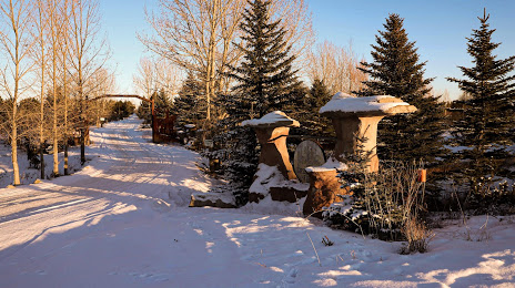
Photo
Where is located The Saskatoon Farm
The Saskatoon Farm — local attraction, which is located at 80181 338 Ave E #20, Alberta T1S 4S3, Canada and belongs to the category — tourist attraction. Average visitor rating for this place — 4.6 (according to 1461 rating, information from open sources and relevant for 2022).
Exact location — The Saskatoon Farm, marked on the map with a red marker.
You can get directions to The Saskatoon Farm on the map from your location.
What else is interesting in Okotoks? You can see all the sights if you go to the city page.
Coordinates
The Saskatoon Farm, Canada coordinates in decimal format: latitude — 50.74607711565945, longitude — -113.86633080173291. When converted to degrees, minutes, seconds The Saskatoon Farm has the following coordinates: 50°44′45.88 north latitude and -113°51′58.79 east longitude.
Nearby cities
The largest cities that are located nearby:
- Calgary — 36 km
- Edmonton — 313 km
- Kelowna — 404 km
- Spokane
 (United States) — 425 km
 - Saskatoon — 520 km
- Abbotsford — 633 km
- Coquitlam — 656 km
- Anmore — 659 km
- Regina — 660 km
- Surrey — 664 km
- Burnaby — 668 km
- Vancouver — 679 km
- Delta — 680 km
- Richmond — 684 km
- Bellevue (United States) — 703 km
- Seattle (United States) — 712 km
- Victoria — 734 km
- Tacoma (United States) — 743 km
- Boise (United States) — 806 km
Distance to the capital
Distance to the capital (Ottawa) is about — 2864 km.