 Pointe-à-la-Croix
Sainte-Irène, Quebec
Marsoui
Hecla
Muskrat Dam
Wunnummin Lake
Sainte-Brigitte-de-Laval
Drayton
Mauricie
Pointe-à-la-Croix
Sainte-Irène, Quebec
Marsoui
Hecla
Muskrat Dam
Wunnummin Lake
Sainte-Brigitte-de-Laval
Drayton
Mauricie
Brantford Golf & Country Club on the map, Brantford, Canada
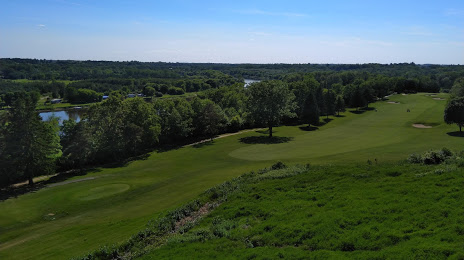
Photo
Where is located Brantford Golf & Country Club
Brantford Golf & Country Club — local attraction, which is located at 60 Ava Rd, Brantford, ON N3T 5R7, Canada and belongs to the category — golf club. Average visitor rating for this place — 4.6 (according to 191 rating, information from open sources and relevant for 2022).
Exact location — Brantford Golf & Country Club, marked on the map with a red marker.
You can get directions to Brantford Golf & Country Club on the map from your location.
What else is interesting in Brantford? You can see all the sights if you go to the city page.
Coordinates
Brantford Golf & Country Club, Canada coordinates in decimal format: latitude — 43.16014909255884, longitude — -80.29415180199321. When converted to degrees, minutes, seconds Brantford Golf & Country Club has the following coordinates: 43°9′36.54 north latitude and -80°17′38.95 east longitude.
Nearby cities
The largest cities that are located nearby:
- Cambridge — 25 km
- Hamilton — 34 km
- Kitchener — 35 km
- Waterloo — 41 km
- Burlington — 43 km
- Guelph — 45 km
- Oakville — 59 km
- Mississauga — 70 km
- Brampton — 77 km
- London — 81 km
- Saint Catharines — 82 km
- Toronto — 91 km
- Vaughan — 98 km
- Richmond Hill — 105 km
- Markham — 108 km
- Buffalo
 (United States) — 116 km
 - Amherst (United States) — 121 km
- Whitby — 135 km
- Boston (United States) — 136 km
Distance to the capital
Distance to the capital (Ottawa) is about — 444 km.