
 Puerto de la Duquesa
La Serna de Iguña
Pumalverde
Puentenansa
La Iglesia
Casar de Periedo
Fuengirola
Renedo de Piélagos
Villabanez
Puerto de la Duquesa
La Serna de Iguña
Pumalverde
Puentenansa
La Iglesia
Casar de Periedo
Fuengirola
Renedo de Piélagos
Villabanez
Parque Forestal La Atalaya on the map, Ciudad Real, Spain
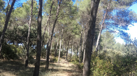
Photo
Where is located Parque Forestal La Atalaya
Parque Forestal La Atalaya — local attraction, which is located at 13005 Ciudad Real, Spain and belongs to the category — park. Average visitor rating for this place — 4.5 (according to 315 ratings, information from open sources and relevant for 2022).
Exact location — Parque Forestal La Atalaya, marked on the map with a red marker.
You can get directions to Parque Forestal La Atalaya on the map from your location.
What else is interesting in Ciudad Real? You can see all the sights if you go to the city page.
Coordinates
Parque Forestal La Atalaya, Spain coordinates in decimal format: latitude — 39.02430053452582, longitude — -3.9127501924116994. When converted to degrees, minutes, seconds Parque Forestal La Atalaya has the following coordinates: 39°1′27.48 north latitude and -3°54′45.9 east longitude.
Nearby cities
The largest cities that are located nearby:
- Jaén — 134 km
- Córdoba — 142 km
- Fuenlabrada — 145 km
- Getafe — 147 km
- Móstoles — 148 km
- Leganés — 150 km
- Alcorcón — 151 km
- Torrejón de Ardoz — 167 km
- Alcala de Henares — 172 km
- Alcobendas — 173 km
- Albacete — 178 km
- Granada — 202 km
- Málaga — 254 km
- Dos Hermanas — 257 km
- Badajoz — 262 km
- Salamanca — 263 km
- Murcia — 267 km
- Almería — 271 km
- Marbella — 286 km
Distance to the capital
Distance to the capital (Madrid) is about — 156 km.