
 San Miguel
Riobamba
Esmeraldas
Otavalo
La Troncal
Pasaje Canton
Palestina
Tosagua
Babahoyo
Loja
Portoviejo
Cuenca
Santo Domingo
Sangolqui
Ambato
Guayaquil
Quito
Progreso
San Miguel
Riobamba
Esmeraldas
Otavalo
La Troncal
Pasaje Canton
Palestina
Tosagua
Babahoyo
Loja
Portoviejo
Cuenca
Santo Domingo
Sangolqui
Ambato
Guayaquil
Quito
Progreso
Macas on the map, Ecuador
Where is located Macas
Exact location — Macas, Morona-Santiago, Ecuador, marked on the map with a red marker.
Coordinates
Macas, Ecuador coordinates in decimal format: latitude — -2.3062241, longitude — -78.1153707. When converted to degrees, minutes, seconds Macas has the following coordinates: -2°18′22.41 north latitude and -78°6′55.33 east longitude.
Population
Macas, Morona-Santiago, Ecuador, according to our data the population is — 23,687 residents, which is about 0.1% of the total population of the country (Ecuador).
Comparison of the population on the graph:
Exact time
Time zone for this location Macas — UTC -5 America/Guayaquil. Exact time — sunday, 4 april 2024 year, 10 h. 50 minutes.
Sunrise and sunset
Macas, sunrise and sunset data for a date — sunday 28.04.2024.
| Sunrise | Sunset | Day (duration) |
|---|---|---|
| 06:11 -0 minutes | 18:08 -0 minutes | 12 h. 0 minutes. -0 minutes |
You can control the scale of the map using the auxiliary tools to find out exactly where it is located Macas. When you change the scale of the map, the width of the ruler also changes (in kilometers and miles).
Nearby cities
The largest cities that are located nearby:
- Riobamba — 93 km
- Cuenca — 118 km
- Ambato — 130 km
- Milagro — 164 km
- Guayaquil — 200 km
- Quevedo — 206 km
- Santiago — 209 km
- Loja — 221 km
- Santo Domingo — 255 km
- Tumbes
 (Peru) — 290 km
 - Portoviejo — 293 km
- Ibarra — 295 km
- Manta — 323 km
- Pasto
 (Colombia) — 401 km
 - Sullana (Peru) — 403 km
- Piura (Peru) — 423 km
- Talara (Peru) — 429 km
- Florencia (Colombia) — 514 km
- Chiclayo (Peru) — 529 km
Distance to neighboring capitals:
- Bogota (Colombia) — 890 km
- Caracas
 (Venezuela) — 1888 km
 - Nuestra Señora de La Paz
 (Bolivia) — 1919 km
 - Santiago
 (Chile) — 3549 km
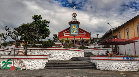
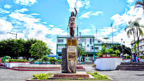
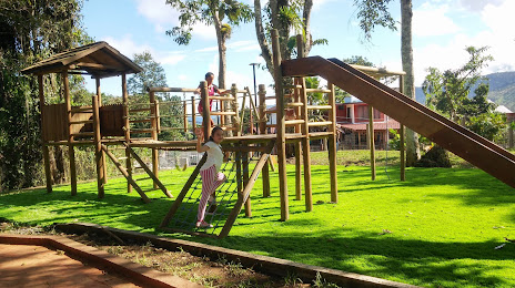
Attractions
Distance to the capital
Distance to the capital (Quito) is about — 240 km.