Nacajuca — Padilla
Nacajuca — Mezcala
Nacajuca — San Ignacio
Nacajuca — Agua Zarca
Nacajuca — Corregidora
Nacajuca — Santa Rita Tlahuapan
Nacajuca — Ciudad Madera
Nacajuca — El Tunal
Nacajuca — Las Rosas
Nacajuca — Viejo
Nacajuca — Tacotalpa
Nacajuca — Aeropuerto Internacional de Culiacán
Nacajuca — El Sauzal
Nacajuca — Mayapán
Nacajuca — Costa Verde
Nacajuca — Jacona
Nacajuca — Puerto Arista
Nacajuca — Tabí
Nacajuca — Ciudad del Carmen
Arroyo
Lomitas
Saloya 2da
Constitución
Acachapan
Carlos Rovirosa Pérez International Airport
Macuspana
José María Pino Suárez
Salto de Agua
Ocosingo
Altamirano
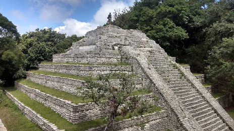
Yaxhá
Nacajuca — Padilla
Nacajuca — Mezcala
Nacajuca — San Ignacio
Nacajuca — Agua Zarca
Nacajuca — Corregidora
Nacajuca — Santa Rita Tlahuapan
Nacajuca — Ciudad Madera
Nacajuca — El Tunal
Nacajuca — Las Rosas
Nacajuca — Viejo
Nacajuca — Tacotalpa
Nacajuca — Aeropuerto Internacional de Culiacán
Nacajuca — El Sauzal
Nacajuca — Mayapán
Nacajuca — Costa Verde
Nacajuca — Jacona
Nacajuca — Puerto Arista
Nacajuca — Tabí
Nacajuca — Ciudad del Carmen
Arroyo
Lomitas
Saloya 2da
Constitución
Acachapan
Carlos Rovirosa Pérez International Airport
Macuspana
José María Pino Suárez
Salto de Agua
Ocosingo
Altamirano
Yaxhá
Nacajuca — Comitan distance, route on the map
Distance by car
Distance between Nacajuca, Tabasco, Mexico and Comitan, Chiapas, Mexico by car is — km, or miles. To travel this distance by car, you need minute, or h.
Route on the map, driving directions
Car route Nacajuca — Comitan was created automatically. The road on the map is shown as a blue line. By moving the markers, you can create a new route through the points you need.
Passing cities through which the car route passes: Nacajuca, Arroyo, Lomitas, Saloya 2da, Constitución, Acachapan, Carlos Rovirosa Pérez International Airport, Macuspana, José María Pino Suárez, Salto de Agua, Ocosingo, Altamirano, Yaxhá.
Distance by plane
If you decide to take a trip Nacajuca Comitan by plane, then you have to fly the distance — 234 km or 145 miles. It is marked on the map with a gray line (between two points in a straight line).
Flight time
Estimated flight time Nacajuca Comitan by plane at cruising speed 750 km / h will be — 18 min.
Direction of movement
Mexico, Nacajuca — right-hand traffic. Mexico, Comitan — right-hand traffic.
Difference in time
Nacajuca and Comitan are in the same time zone. Between them there is no time difference (UTC -6 America/Mexico_City).
Interesting Facts
Information on alternative ways to get to your destination.
The length of this distance is about 0.6% of the total length of the equator.
The percentage of the population is clearly shown in the graph:
Nacajuca — 9,471 (less by 70,473), Comitan — 79,944 residents.
The cost of travel
Calculate the cost of the trip yourself using the fuel consumption calculator, changing the data in the table.