
 Bel-Ha
San Jose El Alto
El Porvenir
Nueva Palestina
Santa Lucía
Chemax
La Morita
Temoac
Zacualpan
Bel-Ha
San Jose El Alto
El Porvenir
Nueva Palestina
Santa Lucía
Chemax
La Morita
Temoac
Zacualpan
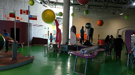
Papagayo Interactive Museum (Museo Interactivo Papagayo) on the map, Villahermosa, Mexico
Photo
Where is located Papagayo Interactive Museum (Museo Interactivo Papagayo)
Papagayo Interactive Museum (Museo Interactivo Papagayo) — local attraction, which is located at Prolongacion de Paseo Usumacinta 2005 Ranchería Emiliano Zapata, 86280 Villahermosa, Tab., Mexico and belongs to the category — museum. Average visitor rating for this place — 4.3 (according to 1225 ratings, information from open sources and relevant for 2022).
Exact location — Papagayo Interactive Museum (Museo Interactivo Papagayo), marked on the map with a red marker.
You can get directions to Papagayo Interactive Museum (Museo Interactivo Papagayo) on the map from your location.
What else is interesting in Villahermosa? You can see all the sights if you go to the city page.
Coordinates
Papagayo Interactive Museum (Museo Interactivo Papagayo), Mexico coordinates in decimal format: latitude — 18.00629966018735, longitude — -92.966490892931. When converted to degrees, minutes, seconds Papagayo Interactive Museum (Museo Interactivo Papagayo) has the following coordinates: 18°0′22.68 north latitude and -92°57′59.37 east longitude.
Nearby cities
The largest cities that are located nearby:
- Tuxtla Gutiérrez — 138 km
- Ciudad del Carmen — 140 km
- San Cristóbal de las Casas — 142 km
- Coatzacoalcos — 160 km
- Minatitlán — 169 km
- Campeche — 323 km
- Tapachula — 349 km
- Quetzaltenango
 (Guatemala) — 381 km
 - Oaxaca — 412 km
- Córdoba — 428 km
- San Juan Sacatepéquez (Guatemala) — 438 km
- Orizaba — 445 km
- Xalapa — 447 km
- Guatemala City (Guatemala) — 454 km
- Villa Nueva (Guatemala) — 459 km
- Villa Canales (Guatemala) — 468 km
- Escuintla (Guatemala) — 469 km
- Tehuacán — 470 km
- Merida — 478 km
Distance to the capital
Distance to the capital (Mexico City) is about — 669 km.