
 Bel-Ha
San Jose El Alto
El Porvenir
Nueva Palestina
Santa Lucía
Chemax
La Morita
Temoac
Zacualpan
Bel-Ha
San Jose El Alto
El Porvenir
Nueva Palestina
Santa Lucía
Chemax
La Morita
Temoac
Zacualpan
Sabal Playa Beach Club (Sabal Playa) on the map, Puerto Vallarta, Mexico
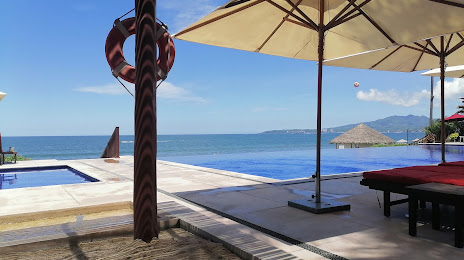
Photo
Where is located Sabal Playa Beach Club (Sabal Playa)
Sabal Playa Beach Club (Sabal Playa) — local attraction, which is located at Paseo de los Cocoteros 114 A, Flamingos, 63732 Nuevo Vallarta, Nay., Mexico and belongs to the category — recreation center. Average visitor rating for this place — 4.6 (according to 50 ratings, information from open sources and relevant for 2022).
Exact location — Sabal Playa Beach Club (Sabal Playa), marked on the map with a red marker.
You can get directions to Sabal Playa Beach Club (Sabal Playa) on the map from your location.
What else is interesting in Puerto Vallarta? You can see all the sights if you go to the city page.
Coordinates
Sabal Playa Beach Club (Sabal Playa), Mexico coordinates in decimal format: latitude — 20.72618444474043, longitude — -105.31095589283827. When converted to degrees, minutes, seconds Sabal Playa Beach Club (Sabal Playa) has the following coordinates: 20°43′34.26 north latitude and -105°18′39.44 east longitude.
Nearby cities
The largest cities that are located nearby:
- Tepic — 100 km
- Zapopan — 187 km
- Manzanillo — 194 km
- Guadalajara — 194 km
- Tlaquepaque — 198 km
- Tonalá — 205 km
- Colima — 221 km
- Mazatlán — 311 km
- Zamora — 314 km
- Aguascalientes — 330 km
- Zacatecas — 357 km
- Uruapan — 359 km
- Fresnillo — 368 km
- León — 369 km
- Durango — 378 km
- Irapuato — 400 km
- Salamanca — 417 km
- Morelia — 432 km
- Celaya — 457 km
Distance to the capital
Distance to the capital (Mexico City) is about — 661 km.