Igarapé — Guarulhos
Igarapé — Penedo
Igarapé — Pirajuí
Igarapé — Pontalinda
Igarapé — Itobi
Igarapé — Feira Nova
Igarapé — Conde
Igarapé — Barcarena
Igarapé — Roque Gonzales
Igarapé — Piratininga
Igarapé — Uruguayana
Igarapé — Lapa
Igarapé — Bady Bassitt
Igarapé — Caldas
Igarapé — Quinta do Sol
Igarapé — Santa Helena
Igarapé — Itamogi
Igarapé — São João da Barra
Igarapé — Medeiros
Oliveira
Oliveira
Santo Antônio do Amparo
Carmo da Cachoeira
Carmo da Cachoeira
Três Corações
Campanha
São Sebastião da Bela Vista
Pouso Alegre
Cambuí
Camanducaia
Extrema
Atibaia
Mairiporã
Mairiporã
Guarulhos
Tucuruvi
State of São Paulo
Cheers
Congonhas-São Paulo Airport
Diadema
Cooperativa
Cubatão
São Vicente
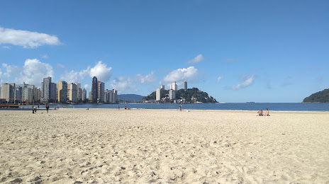
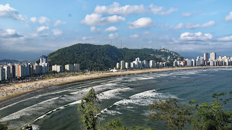
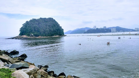
Igarapé — São Vicente distance, route on the map
Distance by car
Distance between Igarapé, Minas Gerais, Brazil and São Vicente, São Paulo, Brazil by car is — km, or miles. To travel this distance by car, you need minute, or h.
Route on the map, driving directions
Car route Igarapé — São Vicente was created automatically. The road on the map is shown as a blue line. By moving the markers, you can create a new route through the points you need.
Passing cities through which the car route passes: Itatiaiuçu, Oliveira, Oliveira, Santo Antônio do Amparo, Carmo da Cachoeira, Carmo da Cachoeira, Três Corações, Campanha, São Sebastião da Bela Vista, Pouso Alegre, Cambuí, Camanducaia, Extrema, Atibaia, Mairiporã, Mairiporã, Guarulhos, Tucuruvi, State of São Paulo, Cheers, Congonhas-São Paulo Airport, Diadema, Cooperativa, Cubatão, São Vicente.
Distance by plane
If you decide to take a trip Igarapé São Vicente by plane, then you have to fly the distance — 484 km or 300 miles. It is marked on the map with a gray line (between two points in a straight line).
Flight time
Estimated flight time Igarapé São Vicente by plane at cruising speed 750 km / h will be — 38 min.
Direction of movement
Brazil, Igarapé — right-hand traffic. Brazil, São Vicente — right-hand traffic.
Difference in time
Igarapé and São Vicente are in the same time zone. Between them there is no time difference (UTC -3 America/Sao_Paulo).
Interesting Facts
Information on alternative ways to get to your destination.
The length of this distance is about 1.2% of the total length of the equator.
The percentage of the population is clearly shown in the graph:
Igarapé — 21,427 (less by 303,037), São Vicente — 324,464 residents.
The cost of travel
Calculate the cost of the trip yourself using the fuel consumption calculator, changing the data in the table.