
 Belém
Maranguape
Paranaguá
Paranaguá
Monte Alegre
Alvorada de Minas
Bragança
Laguna
Ibiporã
Belém
Maranguape
Paranaguá
Paranaguá
Monte Alegre
Alvorada de Minas
Bragança
Laguna
Ibiporã
Mangal das Garças on the map, Belém, Brazil
Photo
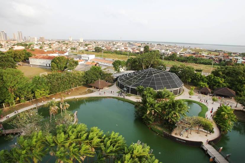
Where is located Mangal das Garças
Mangal das Garças — local attraction, which is located at R. Carneiro da Rocha, s/n - Cidade Velha, Belém - PA, 66020-160, Brazil and belongs to the category — ecological park. Average visitor rating for this place — 4.8 (according to 15813 ratings, information from open sources and relevant for 2022).
Exact location — Mangal das Garças, marked on the map with a red marker.
You can get directions to Mangal das Garças on the map from your location.
What else is interesting in Belém? You can see all the sights if you go to the city page.
Coordinates
Mangal das Garças, Brazil coordinates in decimal format: latitude — -1.464597326249017, longitude — -48.505681543011704. When converted to degrees, minutes, seconds Mangal das Garças has the following coordinates: -1°27′52.55 north latitude and -48°30′20.45 east longitude.
Nearby cities
The largest cities that are located nearby:
- Ananindeua — 16 km
- Castanhal — 66 km
- Macapá — 330 km
- Marabá — 440 km
- Imperatriz — 463 km
- São Luís — 480 km
- Araguaína — 635 km
- Caxias — 679 km
- Santarém — 695 km
- Timon — 742 km
- Teresina — 744 km
- Parnaíba — 759 km
- Palmas — 972 km
- Paramaribo
 (Suriname) — 1095 km
 - Caucaia — 1113 km
- Maracanaú — 1120 km
- Fortaleza — 1128 km
- Juazeiro do Norte — 1192 km
- Petrolina — 1236 km