
 Petoa
Gracias
La Sabana
La Bueso
Villa Nueva
Guaymitas
Chotepe
Trinidad
Atima
La Entrada
El Higuero
San Luis
La Lima
Flores
Puerto Cortes
Coxen Hole
El Porvenir
San Manuel
Zambrano
Petoa
Gracias
La Sabana
La Bueso
Villa Nueva
Guaymitas
Chotepe
Trinidad
Atima
La Entrada
El Higuero
San Luis
La Lima
Flores
Puerto Cortes
Coxen Hole
El Porvenir
San Manuel
Zambrano
Santa Rosa de Copan on the map, Honduras
Where is located Santa Rosa de Copan
Exact location — Santa Rosa de Copan, Copan, Honduras, marked on the map with a red marker.
Coordinates
Santa Rosa de Copan, Honduras coordinates in decimal format: latitude — 14.766667, longitude — -88.783333. When converted to degrees, minutes, seconds Santa Rosa de Copan has the following coordinates: 14°46′0 north latitude and -88°46′60 east longitude.
Population
Santa Rosa de Copan, Copan, Honduras, according to our data the population is — 27,756 residents, which is about 0.3% of the total population of the country (Honduras).
Comparison of the population on the graph:
Exact time
Time zone for this location Santa Rosa de Copan — UTC -6 America/Tegucigalpa. Exact time — wednesday, 5 may 2024 year, 23 h. 02 minutes.
Sunrise and sunset
Santa Rosa de Copan, sunrise and sunset data for a date — wednesday 8.05.2024.
| Sunrise | Sunset | Day (duration) |
|---|---|---|
| 05:31 -0 minutes | 18:11 -0 minutes | 12 h. 42 minutes. -0 minutes |
You can control the scale of the map using the auxiliary tools to find out exactly where it is located Santa Rosa de Copan. When you change the scale of the map, the width of the ruler also changes (in kilometers and miles).
Nearby cities
The largest cities that are located nearby:
- San Pedro Sula — 114 km
- Apopa
 (El Salvador) — 114 km
 - Santa Ana (El Salvador) — 121 km
- Soyapango (El Salvador) — 123 km
- Mejicanos (El Salvador) — 123 km
- El Progreso — 126 km
- San Salvador (El Salvador) — 128 km
- Choloma — 128 km
- Santa Tecla (El Salvador) — 132 km
- San Miguel (El Salvador) — 157 km
- Villa Canales
 (Guatemala) — 188 km
 - Guatemala City (Guatemala) — 188 km
- Villa Nueva (Guatemala) — 195 km
- San Juan Sacatepéquez (Guatemala) — 199 km
- Escuintla (Guatemala) — 221 km
- La Ceiba — 235 km
- Quetzaltenango (Guatemala) — 292 km
- Chinandega
 (Nicaragua) — 297 km
 - Lion (Nicaragua) — 330 km
Distance to neighboring capitals:
- San Salvador (El Salvador) — 128 km
- Guatemala City (Guatemala) — 189 km
- Belmopan
 (Belize) — 276 km
 - Managua (Nicaragua) — 401 km
- San Jose
 (Costa Rica) — 741 km
 - Mexico City
 (Mexico) — 1216 km
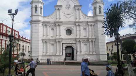
Attractions
Distance to the capital
Distance to the capital (Tegucigalpa) is about — 185 km.