
 Lagune Verdo
Prieta
Tocoa
San Nicolás
Santa Rosa de Copan
Coyoles Central
Vallecillo
Sabana Grande
Omoa
La Jutosa
Villanueva
El Progreso
Choloma
Esparta
Cerro Grande
LA GUAMA
San Pedro Sula
La Ceiba
San Pedro Sula
Lagune Verdo
Prieta
Tocoa
San Nicolás
Santa Rosa de Copan
Coyoles Central
Vallecillo
Sabana Grande
Omoa
La Jutosa
Villanueva
El Progreso
Choloma
Esparta
Cerro Grande
LA GUAMA
San Pedro Sula
La Ceiba
San Pedro Sula
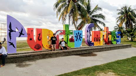
Puerto Cortes on the map, Honduras
Where is located Puerto Cortes
Exact location — Puerto Cortes, Cortés, Honduras, marked on the map with a red marker.
Coordinates
Puerto Cortes, Honduras coordinates in decimal format: latitude — 15.825072, longitude — -87.9285777. When converted to degrees, minutes, seconds Puerto Cortes has the following coordinates: 15°49′30.26 north latitude and -87°55′42.88 east longitude.
Population
Puerto Cortes, Cortés, Honduras, according to our data the population is — 48,020 residents, which is about 0.5% of the total population of the country (Honduras).
Comparison of the population on the graph:
Exact time
Time zone for this location Puerto Cortes — UTC -6 America/Tegucigalpa. Exact time — thursday, 5 may 2024 year, 12 h. 00 minutes.
Sunrise and sunset
Puerto Cortes, sunrise and sunset data for a date — thursday 2.05.2024.
| Sunrise | Sunset | Day (duration) |
|---|---|---|
| 05:29 -0 minutes | 18:08 +1 minute | 12 h. 42 minutes. +1 minute |
You can control the scale of the map using the auxiliary tools to find out exactly where it is located Puerto Cortes. When you change the scale of the map, the width of the ruler also changes (in kilometers and miles).
Nearby cities
The largest cities that are located nearby:
- Choloma — 25 km
- San Pedro Sula — 38 km
- El Progreso — 49 km
- La Ceiba — 117 km
- Apopa
 (El Salvador) — 260 km
 - San Miguel (El Salvador) — 261 km
- Soyapango (El Salvador) — 267 km
- Santa Ana (El Salvador) — 269 km
- Mejicanos (El Salvador) — 269 km
- San Salvador (El Salvador) — 273 km
- Santa Tecla (El Salvador) — 279 km
- Chetumal
 (Mexico) — 298 km
 - Guatemala City
 (Guatemala) — 309 km
 - Villa Canales (Guatemala) — 314 km
- San Juan Sacatepéquez (Guatemala) — 315 km
- Villa Nueva (Guatemala) — 319 km
- Escuintla (Guatemala) — 350 km
- Chinandega
 (Nicaragua) — 364 km
 - Lion (Nicaragua) — 392 km
Distance to neighboring capitals:
- Belmopan
 (Belize) — 182 km
 - San Salvador (El Salvador) — 275 km
- Guatemala City (Guatemala) — 311 km
- Managua (Nicaragua) — 448 km
- San Jose
 (Costa Rica) — 777 km
 - Mexico City (Mexico) — 1253 km
Attractions
Distance to the capital
Distance to the capital (Tegucigalpa) is about — 208 km.