
 Los Mangos
Guangololo
Las Crucitas
Descombros
Santa Elena
Dixon Cove
El Ocotal
Bijagual
Cayo Sierra
Los Mangos
Guangololo
Las Crucitas
Descombros
Santa Elena
Dixon Cove
El Ocotal
Bijagual
Cayo Sierra
Playa de Cienaguita on the map, Puerto Cortes, Honduras
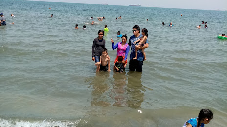
Photo
Where is located Playa de Cienaguita
Playa de Cienaguita — local attraction, which is located at no data and belongs to the category — -. Average visitor rating for this place — 4.6 (according to 139 ratings, information from open sources and relevant for 2022).
Exact location — Playa de Cienaguita, marked on the map with a red marker.
You can get directions to Playa de Cienaguita on the map from your location.
What else is interesting in Puerto Cortes? You can see all the sights if you go to the city page.
Coordinates
Playa de Cienaguita, Honduras coordinates in decimal format: latitude — 15.807728259243204, longitude — -87.95142533346659. When converted to degrees, minutes, seconds Playa de Cienaguita has the following coordinates: 15°48′27.82 north latitude and -87°57′5.13 east longitude.
Nearby cities
The largest cities that are located nearby:
- Choloma — 25 km
- San Pedro Sula — 38 km
- El Progreso — 49 km
- La Ceiba — 117 km
- Apopa
 (El Salvador) — 260 km
 - San Miguel (El Salvador) — 261 km
- Soyapango (El Salvador) — 267 km
- Santa Ana (El Salvador) — 269 km
- Mejicanos (El Salvador) — 269 km
- San Salvador (El Salvador) — 273 km
- Santa Tecla (El Salvador) — 279 km
- Chetumal
 (Mexico) — 298 km
 - Guatemala City
 (Guatemala) — 309 km
 - Villa Canales (Guatemala) — 314 km
- San Juan Sacatepéquez (Guatemala) — 315 km
- Villa Nueva (Guatemala) — 319 km
- Escuintla (Guatemala) — 350 km
- Chinandega
 (Nicaragua) — 364 km
 - Lion (Nicaragua) — 392 km
Distance to the capital
Distance to the capital (Tegucigalpa) is about — 207 km.