
 Józefów nad Wisłą
Gorzyce Wielkie
Rogówek
Sromowce Niżne
Wyszków County
Kruszewo
Jantar
Sady Górne
Nagoszewo
Józefów nad Wisłą
Gorzyce Wielkie
Rogówek
Sromowce Niżne
Wyszków County
Kruszewo
Jantar
Sady Górne
Nagoszewo
Bażantarnia/Elbląg on the map, Elblag, Poland
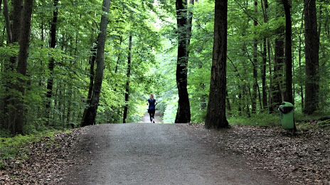
Photo
Where is located Bażantarnia/Elbląg
Bażantarnia/Elbląg — local attraction, which is located at 82-317 Elblag, Poland and belongs to the category — park. Average visitor rating for this place — 4.8 (according to 542 ratings, information from open sources and relevant for 2022).
Exact location — Bażantarnia/Elbląg, marked on the map with a red marker.
You can get directions to Bażantarnia/Elbląg on the map from your location.
What else is interesting in Elblag? You can see all the sights if you go to the city page.
Coordinates
Bażantarnia/Elbląg, Poland coordinates in decimal format: latitude — 54.17482658148556, longitude — 19.446423698236348. When converted to degrees, minutes, seconds Bażantarnia/Elbląg has the following coordinates: 54°10′29.38 north latitude and 19°26′47.13 east longitude.
Nearby cities
The largest cities that are located nearby:
- Gdańsk — 53 km
- Gdynia — 69 km
- Olsztyn — 82 km
- Kaliningrad
 (Russia) — 94 km
 - Torun — 137 km
- Bydgoszcz — 147 km
- Wloclawek — 168 km
- Plock — 179 km
- Klaipėda
 (Lithuania) — 203 km
 - Koszalin — 209 km
- Poznań — 256 km
- Łódź — 265 km
- Bialystok — 274 km
- Kalisz — 279 km
- Kaunas (Lithuania) — 298 km
- Šiauliai (Lithuania) — 312 km
- Gorzów Wielkopolski — 320 km
- Radom — 327 km
- Szczecin — 330 km
Distance to the capital
Distance to the capital (Warsaw) is about — 240 km.